|
search place name
|
||
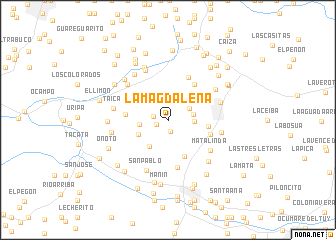
La Magdalena (Miranda, Venezuela)La Magdalena is a town in the Miranda region of Venezuela. An overview map of the region around La Magdalena is displayed below.
regional and 3d topo map of La Magdalena, Venezuela ::
La Magdalena airports ::
The nearest airport is CCS - Caracas Simon Bolivar Intl, located 42.1 km north of La Magdalena.
Other airports nearby include VLN - Valencia Arturo Michelena Intl (112.0 km west), PBL - Puerto Cabello General Bartolome Salom Intl (130.4 km west), VDP - Valle De La Pascua (150.2 km south east), SFH - San Felipe Sub Teniente Nestor Arias (202.3 km west), Nearby towns ::
El Trompillo (1.3km south) //
Sacua Arriba (1.4km west) //
La Cabrera (1.6km west) //
El Vapor (2.6km north east) //
Punta Brava (2.8km east) //
Mume Arriba (2.9km east) //
El Hoyo de Las Nieves (3.2km west) //
Subida de Las Mayas (3.5km south west) //
Sacua Abajo (3.6km south west) //
El Hato (3.7km north west) //
Quebrada de Cúa (4.5km south east) //
El Dividive (4.5km east) //
Las Tejerías (4.7km west) //
Arcos (4.9km north east) //
Cantarranas (4.9km east) //
Cujisito (4.9km east) //
Boca de Mesía (5.2km north east) //
La Culebra (5.4km south) //
Mata Linda (5.8km south east) //
Corralito (5.9km north west) //
San Pablo (6.1km south) //
Los Lirios (6.1km north west) //
Charallave (6.1km east) //
Taica (6.1km west) //
Pitahaya (6.1km east) //
El Latón (6.2km north west) //
La Chivera (6.3km north east) //
Cachicamo (6.4km north west) //
Los Angelinos (6.3km west) //
[all distances 'as the bird flies' and approximate] 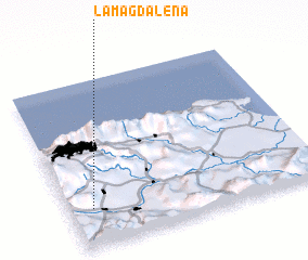 Places with similar names to La Magdalena, Venezuela ::
// La Magdalena (CU)
// La Magdalena (CU)
// La Magdalena (CU)
// La Magdalena (ES)
// La Magdalena (ES)
// La Magdalena (ES)
// La Magdalena (ES)
// La Magdalena (ES)
// La Magdalena (ES)
// La Magdalena (CO)
Disclaimer :: Information on this page comes without warranty of any kind |
||
|
Where is La Magdalena? Elevation and coordinates ::
Latitude (lat): 10°13'52"N Longitude (lon): 66°54'34"W
Elevation (approx.): 875m (map arrows pan, magnifying glasses zoom) |
||
|
Visiting La Magdalena? Hotel/Accommodation ::
Book a hotel in La Magdalena Travel Guide ::
Buy a travel guide for Venezuela rental cars ::
car rental offers GPS waypoint ::
download a GPX waypoint (PoI) of La Magdalena for your GPS receiver
|
||