|
search place name
|
||
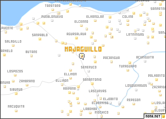
Majagüillo (Falcón, Venezuela)Majagüillo is a town in the Falcón region of Venezuela. An overview map of the region around Majagüillo is displayed below.
regional and 3d topo map of Majagüillo, Venezuela ::
Majagüillo airports ::
The nearest airport is CZE - Coro Jose Leonardo Chirinos, located 26.4 km west of Majagüillo.
Other airports nearby include LSP - Paraguana Josefa Camejo (88.9 km north west), CUR - Willemstad Hato (102.9 km north east), AUA - Oranjestad Reina Beatrix Intl (138.1 km north west), SFH - San Felipe Sub Teniente Nestor Arias (143.8 km south east), Nearby towns ::
La Cañada (2.2km north) //
La Montañita (2.4km west) //
La Muralla (2.6km east) //
El Solito (2.7km east) //
La Florida (2.7km east) //
Los Bailadores (2.7km east) //
El Negro (2.9km north west) //
Semeruco (2.9km south east) //
Paso la Florida (3.7km south west) //
San Pablo (4.2km north east) //
El Portachuelo (5.0km north east) //
Agua Salada (5.1km north) //
El Limón (5.1km south west) //
Guaibacoa (5.3km north west) //
La Fila (5.4km north) //
Barigua Arriba (5.4km west) //
Bariquizal (5.5km north east) //
San Antonio (5.8km south) //
El Buco (5.9km north west) //
Paso de Acurigua (6.2km south) //
La Ensenada (6.3km north) //
Pacarigua (6.3km east) //
El Paso (6.7km south) //
La Lajita (6.9km north) //
Santo Domingo (7.3km north east) //
El Limón (7.3km south west) //
Los Dos Caminos (7.3km north west) //
El Cerro (7.7km north) //
El Cerro (7.8km south) //
[all distances 'as the bird flies' and approximate]  Places with similar names to Majagüillo, Venezuela ::
Disclaimer :: Information on this page comes without warranty of any kind |
||
|
Where is Majagüillo? Elevation and coordinates ::
Latitude (lat): 11°23'17"N Longitude (lon): 69°26'27"W
Elevation (approx.): 147m (map arrows pan, magnifying glasses zoom) |
||
|
Visiting Majagüillo? Hotel/Accommodation ::
Book a hotel in Majagüillo Travel Guide ::
Buy a travel guide for Venezuela rental cars ::
car rental offers GPS waypoint ::
download a GPX waypoint (PoI) of Majagüillo for your GPS receiver
|
||