|
search place name
|
||
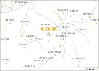
Mucusás (Mérida, Venezuela)Mucusás is a town in the Mérida region of Venezuela. An overview map of the region around Mucusás is displayed below.
regional and 3d topo map of Mucusás, Venezuela ::
Mucusás airports ::
The nearest airport is MRD - Merida Alberto Carnevalli, located 21.2 km north of Mucusás.
Other airports nearby include STB - Santa Barbara Del Zulia (100.7 km north west), BNS - Barinas (113.7 km east), LFR - La Fria (116.1 km west), VLV - Valera Dr Antonio Nicolas Briceno (125.7 km north east), Nearby towns ::
Acequias (3.3km north west) //
Mucutete (4.3km south east) //
San Pedro (4.7km east) //
Tostós (4.8km south west) //
El Cerro (5.6km south east) //
Mucusurú (6.2km south east) //
Mucusós (6.7km east) //
El Morro (6.8km north east) //
Mucuambí (7.0km west) //
Los Barbechos (7.0km east) //
La Paragüita (7.5km north east) //
El Pantanillo (7.6km south) //
El Camacho (8.0km north east) //
Hato Viejo (8.7km north) //
Mocotone (8.9km north) //
El Muerto (9.3km south east) //
Mucuranú (10.0km north east) //
Mocaz (10.8km north east) //
[all distances 'as the bird flies' and approximate] 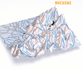 Places with similar names to Mucusás, Venezuela ::
Disclaimer :: Information on this page comes without warranty of any kind |
||
|
Where is Mucusás? Elevation and coordinates ::
Latitude (lat): 8°24'12"N Longitude (lon): 71°13'48"W
Elevation (approx.): 2226m (map arrows pan, magnifying glasses zoom) |
||
|
Visiting Mucusás? Hotel/Accommodation ::
Book a hotel in Mucusás Travel Guide ::
Buy a travel guide for Venezuela rental cars ::
car rental offers GPS waypoint ::
download a GPX waypoint (PoI) of Mucusás for your GPS receiver
|
||