|
search place name
|
||
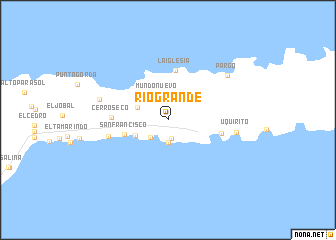
Río Grande (Sucre, Venezuela)Río Grande is a town in the Sucre region of Venezuela. An overview map of the region around Río Grande is displayed below.
regional and 3d topo map of Río Grande, Venezuela ::
Río Grande airports ::
The nearest airport is GUI - Guiria, located 23.2 km south west of Río Grande.
Other airports nearby include POS - Port-of-spain Piarco (85.6 km east), CUP - Carupano General Jose Francisco Bermudez (125.2 km west), TAB - Scarborough Crown Point (150.7 km east), MUN - Maturin (151.5 km south west), Nearby towns ::
Cumaquita (2.1km south) //
Cumaca (2.5km south) //
Carmona (2.8km south west) //
Mundo Nuevo (3.0km north west) //
Chaguaramal (3.6km west) //
Mapire (3.9km south west) //
San Francisco (5.1km west) //
La Iglesia (5.6km north) //
Puerto de Hierro (6.1km east) //
Cerro Seco (6.2km west) //
La Ceiba (6.8km west) //
Uquirito (7.6km east) //
Mejillones (7.9km west) //
Pargo (8.2km north east) //
[all distances 'as the bird flies' and approximate] 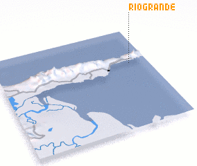 Places with similar names to Río Grande, Venezuela ::
// Rio Grande (BR)
// Rio Grande (BR)
// Rio Grande (BR)
// Rio Grande (BR)
// Rio Grande (BR)
// Rio Grande (BR)
// Río Grande (PA)
// Río Grande (PA)
// Río Grande (PA)
// Rågrend (NO)
Disclaimer :: Information on this page comes without warranty of any kind |
||
|
Where is Río Grande? Elevation and coordinates ::
Latitude (lat): 10°39'22"N Longitude (lon): 62°7'2"W
Elevation (approx.): 256m (map arrows pan, magnifying glasses zoom) |
||
|
Visiting Río Grande? Hotel/Accommodation ::
Book a hotel in Río Grande Travel Guide ::
Buy a travel guide for Venezuela rental cars ::
car rental offers GPS waypoint ::
download a GPX waypoint (PoI) of Río Grande for your GPS receiver
|
||