|
search place name
|
||
San Agustín (Sucre, Venezuela)San Agustín is a town in the Sucre region of Venezuela. An overview map of the region around San Agustín is displayed below.
regional and 3d topo map of San Agustín, Venezuela ::

San Agustín airports ::
The nearest airport is GUI - Guiria, located 47.4 km east of San Agustín.
Other airports nearby include CUP - Carupano General Jose Francisco Bermudez (57.6 km west), MUN - Maturin (111.5 km south west), PMV - Porlamar Del Caribe Intl Gen Santiago Marino (137.5 km west), POS - Port-of-spain Piarco (153.2 km east), Nearby towns ::
La Florida (0.8km south) //
El Brasil (2.2km east) //
La Florida (3.3km west) //
El Cedro (3.3km north east) //
Cumbre Fria (3.6km north west) //
Buenos Aires (3.9km west) //
El Cobre (4.2km east) //
Macanillal (4.5km north) //
La Florida (4.7km north west) //
Pacholí (5.2km south west) //
Altagracia (5.2km south east) //
El Sanche (5.8km east) //
Los Mirtos (5.9km south west) //
Agua Fría (6.0km south west) //
Santa María (6.2km east) //
Pandeo (6.3km south) //
Cayena (6.4km north east) //
Quebrada Seca (6.7km south) //
Río Seco (6.9km south east) //
Cumbre de Caballo (7.0km north west) //
La Guama (7.0km west) //
Cumbre de las Flores (7.4km north) //
Cachipal (7.5km south west) //
La Palmera (7.5km west) //
El Paujil (7.8km south east) //
Los Caballos (7.9km north west) //
Las Catanas (7.8km west) //
San Juan de Unare (7.9km north) //
El Llano (8.0km south east) //
[all distances 'as the bird flies' and approximate] 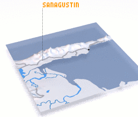 Places with similar names to San Agustín, Venezuela ::
// San Agustin (US)
// San Augustine (US)
// San Agustín (PA)
// San Agustín (PA)
// San Agustín (CU)
// San Agustín (CU)
// San Agustín (CU)
// San Agustín (CU)
// San Agustín (CU)
// San Agustín (CU)
Disclaimer :: Information on this page comes without warranty of any kind |
||
|
Where is San Agustín? Elevation and coordinates ::
Latitude (lat): 10°40'6"N Longitude (lon): 62°44'6"W
Elevation (approx.): 669m (map arrows pan, magnifying glasses zoom) |
||
|
Visiting San Agustín? Hotel/Accommodation ::
Book a hotel in San Agustín Travel Guide ::
Buy a travel guide for Venezuela rental cars ::
car rental offers GPS waypoint ::
download a GPX waypoint (PoI) of San Agustín for your GPS receiver
|
||