|
search place name
|
||
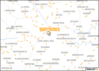
Santa Inés (Falcón, Venezuela)Santa Inés is a town in the Falcón region of Venezuela. An overview map of the region around Santa Inés is displayed below.
regional and 3d topo map of Santa Inés, Venezuela ::
Santa Inés airports ::
The nearest airport is LSP - Paraguana Josefa Camejo, located 22.6 km south west of Santa Inés.
Other airports nearby include AUA - Oranjestad Reina Beatrix Intl (60.8 km north), CZE - Coro Jose Leonardo Chirinos (71.1 km south east), CUR - Willemstad Hato (120.3 km east), BON - Kralendijk Flamingo (193.7 km east), Nearby towns ::
Santa Inés (0.2km south east) //
La Selva (1.9km north) //
Buenos Aires (2.1km north west) //
Montalbán (2.7km west) //
Las Clavellinas (3.2km south west) //
La Correría (3.4km north) //
Caradocagua (3.5km north) //
Plantación (3.5km north west) //
El Socorro (4.2km west) //
San Vicente (4.7km west) //
San Antonio de Acaboa (5.0km north west) //
San Antonio (5.1km north east) //
El Barbasco (5.1km east) //
Sabaneta (5.4km west) //
Sicaname (5.5km south) //
El Yacural (5.6km south east) //
La Florida (6.0km north west) //
Santa Rosalía (6.5km north) //
San José de Cocodite (6.5km east) //
El Isiro (6.7km west) //
Isito (6.9km north west) //
La Sirena (6.9km north east) //
El Centenario (7.0km north) //
El Silencio (7.2km north) //
Piedras Negras (7.2km north west) //
Buenevara (7.3km east) //
Amaraya (7.7km south west) //
Antuni (7.7km north east) //
Tabe (7.6km south west) //
[all distances 'as the bird flies' and approximate] 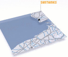 Places with similar names to Santa Inés, Venezuela ::
// Santa Inês (BR)
// Santa Inês (BR)
// Santa Inês (BR)
// Santo Inácio (BR)
// Santo Inácio (BR)
// Santo Inácio (BR)
// Santo Inácio (BR)
// Santo Inácio (BR)
// Santo Inácio (BR)
// Santa Ynez (US)
Disclaimer :: Information on this page comes without warranty of any kind |
||
|
Where is Santa Inés? Elevation and coordinates ::
Latitude (lat): 11°57'9"N Longitude (lon): 70°2'18"W
Elevation (approx.): 105m (map arrows pan, magnifying glasses zoom) |
||
|
Visiting Santa Inés? Hotel/Accommodation ::
Book a hotel in Santa Inés Travel Guide ::
Buy a travel guide for Venezuela rental cars ::
car rental offers GPS waypoint ::
download a GPX waypoint (PoI) of Santa Inés for your GPS receiver
|
||