|
search place name
|
||
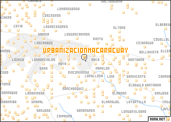
Urbanización Macaracuay (Miranda, Venezuela)Urbanización Macaracuay is a town in the Miranda region of Venezuela. An overview map of the region around Urbanización Macaracuay is displayed below.
regional and 3d topo map of Urbanización Macaracuay, Venezuela ::
Urbanización Macaracuay airports ::
The nearest airport is CCS - Caracas Simon Bolivar Intl, located 23.9 km north west of Urbanización Macaracuay.
Other airports nearby include VLN - Valencia Arturo Michelena Intl (126.9 km west), PBL - Puerto Cabello General Bartolome Salom Intl (137.5 km west), VDP - Valle De La Pascua (165.1 km south east), SFH - San Felipe Sub Teniente Nestor Arias (213.4 km west), Nearby towns ::
Petare (1.2km north) //
Boleita (1.2km north) //
La California (1.3km north) //
El Cafetal (1.4km south west) //
Los Limoncitos (2.2km north east) //
Los Ruices (2.2km north west) //
Maca (2.2km east) //
El Marqués (2.5km north) //
Urbanización Caurimare (2.5km west) //
Campo Claro (2.8km north west) //
La Urbina (2.8km north east) //
El Encantado (3.1km south east) //
Urbanización Horizonte (3.1km north) //
Los Naranjos (3.1km south west) //
Los Chorros (3.6km north west) //
La Carlota (3.6km north west) //
Urbanización Chuao (3.7km west) //
Urbanización Guaicoco (3.7km east) //
Rincón Verde (3.7km south west) //
Colinas de Tamanaco (3.7km west) //
Urbanización San Román (3.7km west) //
Guaricoco (3.7km east) //
La Fenix (3.7km east) //
Las Mercedes (3.8km west) //
El Coche (3.8km east) //
Valle Alto (4.0km east) //
La Dolorita (4.2km north east) //
El Paují (4.3km south) //
El Hatillo (4.3km south) //
[all distances 'as the bird flies' and approximate] 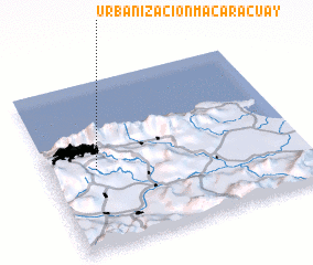 Places with similar names to Urbanización Macaracuay, Venezuela :: Disclaimer :: Information on this page comes without warranty of any kind |
||
|
Where is Urbanización Macaracuay? Elevation and coordinates ::
Latitude (lat): 10°28'20"N Longitude (lon): 66°49'0"W
Elevation (approx.): 885m (map arrows pan, magnifying glasses zoom) |
||
|
Visiting Urbanización Macaracuay? Hotel/Accommodation ::
Book a hotel in Urbanización Macaracuay Travel Guide ::
Buy a travel guide for Venezuela rental cars ::
car rental offers GPS waypoint ::
download a GPX waypoint (PoI) of Urbanización Macaracuay for your GPS receiver
|
||