|
search place name
|
||
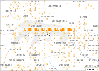
Urbanización Valle Arriba (Miranda, Venezuela)Urbanización Valle Arriba is a town in the Miranda region of Venezuela. An overview map of the region around Urbanización Valle Arriba is displayed below.
regional and 3d topo map of Urbanización Valle Arriba, Venezuela ::
Urbanización Valle Arriba airports ::
The nearest airport is CCS - Caracas Simon Bolivar Intl, located 19.6 km north west of Urbanización Valle Arriba.
Other airports nearby include VLN - Valencia Arturo Michelena Intl (121.7 km west), PBL - Puerto Cabello General Bartolome Salom Intl (132.1 km west), VDP - Valle De La Pascua (168.5 km south east), SFH - San Felipe Sub Teniente Nestor Arias (208.0 km west), Nearby towns ::
Colinas de Bello Monte (1.5km north west) //
Urbanización Chuao (1.8km east) //
Urbanización San Román (1.8km east) //
Maya (1.9km south) //
Colinas de Tamanaco (2.0km south east) //
Las Mercedes (2.0km north east) //
Los Campitos (2.2km south west) //
Curumo (2.6km south west) //
Sabana Grande (2.6km north) //
Los Chaguaramos (2.6km north west) //
La Florida (2.8km north) //
La Ciénega (2.8km south) //
Colinas de Santa Monica (2.9km west) //
Urbanización Caurimare (3.1km east) //
Country Club (3.1km north) //
Urbanización Prados del Este (3.3km south west) //
Mariperez (3.3km north west) //
El Recreo (3.3km north west) //
Los Naranjos (3.3km south east) //
La Castellana (3.3km north east) //
Chacao (3.3km north east) //
Los Palos Grandes (3.3km north east) //
Las Minas (3.6km south) //
Los Marciales (3.8km west) //
UrbanizaciónLa Trinidad (3.8km south) //
Las Acacias (4.0km north west) //
El Peñón (4.1km south west) //
Campo Claro (4.1km north east) //
El Cafetal (4.4km east) //
[all distances 'as the bird flies' and approximate]  Places with similar names to Urbanización Valle Arriba, Venezuela :: Disclaimer :: Information on this page comes without warranty of any kind |
||
|
Where is Urbanización Valle Arriba? Elevation and coordinates ::
Latitude (lat): 10°28'30"N Longitude (lon): 66°52'0"W
Elevation (approx.): 886m (map arrows pan, magnifying glasses zoom) |
||
|
Visiting Urbanización Valle Arriba? Hotel/Accommodation ::
Book a hotel in Urbanización Valle Arriba Travel Guide ::
Buy a travel guide for Venezuela rental cars ::
car rental offers GPS waypoint ::
download a GPX waypoint (PoI) of Urbanización Valle Arriba for your GPS receiver
|
||