|
search place name
|
||
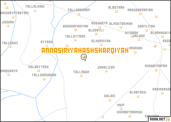
An Nāşirīyah ash Sharqīyah (Al Ḩasakah, Syria)An Nāşirīyah ash Sharqīyah is a town in the Al Ḩasakah region of Syria. An overview map of the region around An Nāşirīyah ash Sharqīyah is displayed below.
regional and 3d topo map of An Nāşirīyah ash Sharqīyah, Syria ::
An Nāşirīyah ash Sharqīyah airports ::
The nearest airport is BAL - Batman, located 146.3 km north west of An Nāşirīyah ash Sharqīyah.
Other airports nearby include DIY - Diyabakir Diyarbakir (196.5 km north west), VAN - Van (224.8 km north east), DEZ - Deire Zor Deir Zzor (228.9 km south west), Nearby towns ::
As Su‘ūdīyah (2.0km north) //
Tall Nā‘ūr (3.4km south) //
Al Būthah (4.2km north west) //
Al Ḩurrīyah (4.5km north east) //
Umm al ‘Iz̧ām (4.3km south east) //
Tall at Tamr (4.9km north) //
An Nāşirīyah (4.6km north west) //
Al Uşayli‘ (6.2km north) //
Ash Sha‘fānīyah (7.0km north) //
Ad Duwaym (7.8km north) //
Aţ Ţāsh (7.5km north west) //
Dalākī (9.6km south east) //
Al Mustarīḩah (9.7km north east) //
[all distances 'as the bird flies' and approximate] 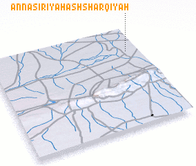 Places with similar names to An Nāşirīyah ash Sharqīyah, Syria :: Disclaimer :: Information on this page comes without warranty of any kind |
||
|
Where is An Nāşirīyah ash Sharqīyah? Elevation and coordinates ::
Latitude (lat): 36°46'49"N Longitude (lon): 41°55'32"E
Elevation (approx.): 377m (map arrows pan, magnifying glasses zoom) |
||
|
Visiting An Nāşirīyah ash Sharqīyah? Hotel/Accommodation ::
Book a hotel in An Nāşirīyah ash Sharqīyah Travel Guide ::
Buy a travel guide for Syria rental cars ::
car rental offers GPS waypoint ::
download a GPX waypoint (PoI) of An Nāşirīyah ash Sharqīyah for your GPS receiver
|
||