|
search place name
|
||
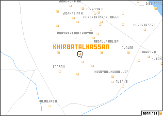
Khirbat al Ḩassān (Ar Raqqah, Syria)Khirbat al Ḩassān is a town in the Ar Raqqah region of Syria. An overview map of the region around Khirbat al Ḩassān is displayed below.
regional and 3d topo map of Khirbat al Ḩassān, Syria ::
Khirbat al Ḩassān airports ::
The nearest airport is ALP - Aleppo Intl, located 87.3 km north west of Khirbat al Ḩassān.
Other airports nearby include GZT - Gaziantep Oguzeli (136.9 km north west), PMS - Palmyra (141.1 km south), Nearby towns ::
Al Qiţaţ (1.0km south) //
Khirbat as Sab‘ (2.7km south east) //
Al Jurayyāt (3.8km south) //
Khirbat Muḩsin (4.0km east) //
Khirbat al Muftāḩīyah (4.7km north) //
As Sulayḩīyah (4.4km west) //
Mushrifat al Bakrī (5.2km north east) //
Tarfāwī (5.1km south west) //
‘Abd Allāh al ‘Īsá (5.5km north east) //
Khirbat Shuwaym (6.3km north east) //
Rasm Fālah (6.7km north) //
Ḩusayn al Mukhallaf (7.2km south east) //
Al Ḩamrā (8.4km north) //
Abū Maḩmūd Daḩḩām Ḩammād (8.5km north east) //
Al Muwaylah (8.0km south east) //
Khirbat Aḩmad al Ḩabīb (8.7km north west) //
Khirbat Aḩmad al Ḩajjī (9.1km north east) //
[all distances 'as the bird flies' and approximate]  Places with similar names to Khirbat al Ḩassān, Syria ::
// Khirbat al Ḩişān (SY)
Disclaimer :: Information on this page comes without warranty of any kind |
||
|
Where is Khirbat al Ḩassān? Elevation and coordinates ::
Latitude (lat): 35°48'50"N Longitude (lon): 38°4'50"E
Elevation (approx.): 346m (map arrows pan, magnifying glasses zoom) |
||
|
Visiting Khirbat al Ḩassān? Hotel/Accommodation ::
Book a hotel in Khirbat al Ḩassān Travel Guide ::
Buy a travel guide for Syria rental cars ::
car rental offers GPS waypoint ::
download a GPX waypoint (PoI) of Khirbat al Ḩassān for your GPS receiver
|
||