|
search place name
|
||
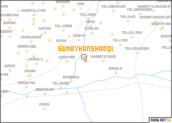
Sumayḩān Sharqī (Al Ḩasakah, Syria)Sumayḩān Sharqī is a town in the Al Ḩasakah region of Syria. An overview map of the region around Sumayḩān Sharqī is displayed below.
regional and 3d topo map of Sumayḩān Sharqī, Syria ::
Sumayḩān Sharqī airports ::
The nearest airport is BAL - Batman, located 136.4 km north of Sumayḩān Sharqī.
Other airports nearby include DIY - Diyabakir Diyarbakir (156.2 km north west), DEZ - Deire Zor Deir Zzor (179.1 km south west), EZS - Elazig (266.8 km north west), Nearby towns ::
Sumayḩān ash Sharqī (0.0km north) //
Khirbat ‘Aţshān (3.0km east) //
Sumayḩān (3.4km west) //
KhirbatShīḩā (3.9km north east) //
Tuwaym (5.0km north) //
As Sabakh (5.1km south west) //
Khāzūq (5.2km north east) //
Qishlah (6.3km north) //
Rūfah (5.7km north west) //
Shas‘ā (6.3km north west) //
Biʼr Ḩulw (5.7km south east) //
Hāmis (7.8km north) //
Tall Birāk (7.2km south west) //
Shūkir (7.5km south west) //
Abū Ḩujayrah (7.5km north east) //
Tall ‘Iz̧ām (7.0km north east) //
Tall Zabīb (8.0km north west) //
Ḩaddāj (6.9km west) //
Khirab Suwayfāt (8.8km north) //
Tall al Faras (7.9km north west) //
Tall al Faras (7.9km north west) //
[all distances 'as the bird flies' and approximate]  Places with similar names to Sumayḩān Sharqī, Syria :: Disclaimer :: Information on this page comes without warranty of any kind |
||
|
Where is Sumayḩān Sharqī? Elevation and coordinates ::
Latitude (lat): 36°42'0"N Longitude (lon): 41°8'0"E
Elevation (approx.): 340m (map arrows pan, magnifying glasses zoom) |
||
|
Visiting Sumayḩān Sharqī? Hotel/Accommodation ::
Book a hotel in Sumayḩān Sharqī Travel Guide ::
Buy a travel guide for Syria rental cars ::
car rental offers GPS waypoint ::
download a GPX waypoint (PoI) of Sumayḩān Sharqī for your GPS receiver
|
||