|
search place name
|
||
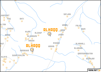
Al Ḩaqq (Oman)Al Ḩaqq is a town in Oman. An overview map of the region around Al Ḩaqq is displayed below.
regional and 3d topo map of Al Ḩaqq, Oman ::
Al Ḩaqq airports ::
The nearest airport is MCT - Muscat Seeb Intl, located 68.5 km north east of Al Ḩaqq.
Other airports nearby include FJR - Fujeirah Fujairah Intl (265.1 km north west), Nearby towns ::
Al ‘Ayn (3.0km south east) //
Jināh (3.6km east) //
Qūrī (3.8km north east) //
Rissah (4.1km south east) //
Al Ghuf (4.1km west) //
Ḩammā (4.8km south) //
Sā‘id (4.4km east) //
Wughlah (5.1km south east) //
Mughbārīyah (5.4km south) //
Bībān (5.8km south) //
Biyāḑ (5.9km north east) //
Wabāl (6.0km north east) //
Al Khadrāʼ (6.3km west) //
Ḩadsh (6.9km west) //
Ḩijār (7.7km west) //
Ḩijār (7.7km west) //
Al Bidāyah (8.1km west) //
Al Ḩaqq (8.4km south west) //
Misfāh al Ḩalfayn (8.7km south west) //
Sayjah (9.2km north east) //
Sīrqān (10.7km south west) //
[all distances 'as the bird flies' and approximate] 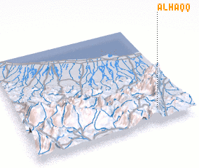 Places with similar names to Al Ḩaqq, Oman ::
Disclaimer :: Information on this page comes without warranty of any kind |
||
|
Where is Al Ḩaqq? Elevation and coordinates ::
Latitude (lat): 23°9'0"N Longitude (lon): 57°49'0"E
Elevation (approx.): 1010m (map arrows pan, magnifying glasses zoom) |
||
|
Visiting Al Ḩaqq? Hotel/Accommodation ::
Book a hotel in Al Ḩaqq Travel Guide ::
Buy a travel guide for Oman rental cars ::
car rental offers GPS waypoint ::
download a GPX waypoint (PoI) of Al Ḩaqq for your GPS receiver
|
||