|
search place name
|
||
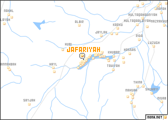
Ja‘farīyah (Oman)Ja‘farīyah is a town in Oman. An overview map of the region around Ja‘farīyah is displayed below.
regional and 3d topo map of Ja‘farīyah, Oman ::
Ja‘farīyah airports ::
The nearest airport is MCT - Muscat Seeb Intl, located 44.5 km north east of Ja‘farīyah.
Other airports nearby include FJR - Fujeirah Fujairah Intl (261.7 km north west), Nearby towns ::
Sharqatayn (0.4km south west) //
Samāʼil (0.5km south) //
‘Alāyat Samāʼil (0.5km south) //
Shāq (0.5km south east) //
Jumārah (0.6km east) //
Sīb (0.7km south) //
Haylī (0.8km south west) //
Khadīrah (1.0km south west) //
Khayfīyah (1.2km south) //
Bākhah (1.2km north east) //
Şulţīyah (1.4km south west) //
Daghālī (1.6km north east) //
Madārah (1.9km east) //
Fujayrah (2.1km south west) //
Murīh (2.5km north east) //
Sāfah (2.7km east) //
Bayt Jabal (2.7km north east) //
Jubaylāt (3.1km north east) //
Ghayl ad Dakk (3.2km east) //
Shurayjah (3.4km east) //
Sufālat Samāʼil (3.8km east) //
Rāsibah (3.8km east) //
Hūbī (4.1km north west) //
Maḩbūb (4.2km north east) //
Ḩājir Rākah (4.3km east) //
At Toyan (4.9km north west) //
Ţawīdah (4.9km east) //
Ghubrah (5.2km east) //
Jaylah (6.4km north east) //
[all distances 'as the bird flies' and approximate] 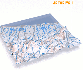 Places with similar names to Ja‘farīyah, Oman ::
Disclaimer :: Information on this page comes without warranty of any kind |
||
|
Where is Ja‘farīyah? Elevation and coordinates ::
Latitude (lat): 23°18'14"N Longitude (lon): 57°58'54"E
Elevation (approx.): 385m (map arrows pan, magnifying glasses zoom) |
||
|
Visiting Ja‘farīyah? Hotel/Accommodation ::
Book a hotel in Ja‘farīyah Travel Guide ::
Buy a travel guide for Oman rental cars ::
car rental offers GPS waypoint ::
download a GPX waypoint (PoI) of Ja‘farīyah for your GPS receiver
|
||