|
search place name
|
||
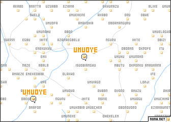
Umu Oye (Gongola, Nigeria)Umu Oye is a town in the Gongola region of Nigeria. An overview map of the region around Umu Oye is displayed below.
regional and 3d topo map of Umu Oye, Nigeria ::
Umu Oye airports ::
The nearest airport is PHC - Port Hartcourt Port Harcourt Intl, located 54.6 km south west of Umu Oye.
Other airports nearby include ENU - Enugu (120.8 km north), CBQ - Calabar (139.3 km east), BNI - Benin (199.9 km north west), SSG - Malabo (252.5 km south east), Nearby towns ::
Isuobiangwu (1.9km south) //
Inyiogugu (2.6km north east) //
Olakwo (5.2km south west) //
Azara Egbelu (5.2km north west) //
Lagwa (5.5km east) //
Umu Iago (5.9km south) //
Abor (6.7km north west) //
Nguru (6.7km north east) //
Umuhu (7.4km east) //
Amakohia (7.4km north) //
Mbutu (7.6km east) //
Ibeku (7.6km east) //
Akalovo (8.3km north west) //
Umu Owa (8.3km south west) //
Awban (8.3km south east) //
Amaibo (10.5km south west) //
Umuofa (10.5km north west) //
Ovoro (10.5km south east) //
Oboama Nguru (10.5km north east) //
[all distances 'as the bird flies' and approximate] 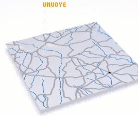 Places with similar names to Umu Oye, Nigeria ::
Disclaimer :: Information on this page comes without warranty of any kind |
||
|
Where is Umu Oye? Elevation and coordinates ::
Latitude (lat): 5°27'0"N Longitude (lon): 7°11'0"E
Elevation (approx.): 112m (map arrows pan, magnifying glasses zoom) |
||
|
Visiting Umu Oye? Hotel/Accommodation ::
Book a hotel in Umu Oye Travel Guide ::
Buy a travel guide for Nigeria rental cars ::
car rental offers GPS waypoint ::
download a GPX waypoint (PoI) of Umu Oye for your GPS receiver
|
||