|
search place name
|
||
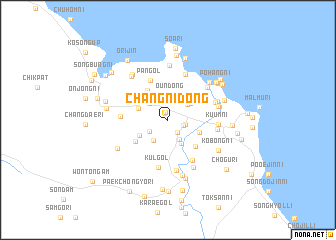
Changni-dong (Kangwŏn, Korea, North)Changni-dong is a town in the Kangwŏn region of Korea, North. An overview map of the region around Changni-dong is displayed below.
regional and 3d topo map of Changni-dong, Korea, North ::
Changni-dong airports ::
The nearest airport is SHO - Sokch'o Sokcho, located 65.5 km south east of Changni-dong.
Other airports nearby include KAG - Kangnung Gangneung (117.9 km south east), SSN - Seoul East Seoul Ab (169.5 km south west), GMP - Seoul Gimpo (178.9 km south west), OSN - Osan Ab (206.4 km south west), Nearby towns ::
Kŭmch'ŏl-li (0.9km north) //
Changjŏng-ni (0.9km north) //
Chŏnsŏng-ni (1.6km south east) //
Naech'im-ni (1.5km south east) //
Malgun-ni (1.6km east) //
Chudul-li (2.1km south west) //
Songt'al-li (2.4km south east) //
Ŏŭn-dong (2.7km north) //
Ponghwa-ri (2.4km north east) //
Yangsong-ni (2.5km north west) //
Yusŏng-ni (2.6km south west) //
Sunhang-ni (2.9km south east) //
Kyewŏl-li (2.6km north east) //
Oeun (3.0km north west) //
Un'gong-ni (3.0km north west) //
Sangsong-ni (2.9km north west) //
Hwau-ri (3.0km south west) //
Hach'ohyŏn (3.0km south east) //
Naeun (3.8km north west) //
Ch'ohyŏl-li (3.8km south east) //
Kanggŏrip'yŏng (3.7km south west) //
Pan-gol (4.6km north) //
Hajŏngwŏl (5.0km south east) //
Yonggye-ri (4.2km west) //
Ch'udong-ni (5.3km north) //
K'ŭl-gol (5.4km south) //
Kojam (4.4km east) //
Sap'yŏng-ni (4.6km north east) //
Pyŏngbangi (5.0km north east) //
[all distances 'as the bird flies' and approximate]  Places with similar names to Changni-dong, Korea, North ::
// Changno-dong (KP)
// Chongno-dong (KP)
// Ch'ŏngun-dong (KP)
// Chunggan-dong (KP)
// Chungni-dong (KP)
// Chungŭn-dong (KP)
// Changan-dong (KR)
// Chŏngnae-dong (KR)
// Ch'ŏngun-dong (KR)
// Ch'ŏngun-dong (KR)
Disclaimer :: Information on this page comes without warranty of any kind |
||
|
Where is Changni-dong? Elevation and coordinates ::
Latitude (lat): 38°40'17"N Longitude (lon): 128°15'58"E
Elevation (approx.): 12m (map arrows pan, magnifying glasses zoom) |
||
|
Visiting Changni-dong? Hotel/Accommodation ::
Book a hotel in Changni-dong Travel Guide ::
rental cars ::
car rental offers GPS waypoint ::
download a GPX waypoint (PoI) of Changni-dong for your GPS receiver
|
||