|
search place name
|
||
Ch'op'yŏng-dong (Hamgyŏng, Korea, North)Ch'op'yŏng-dong is a town in the Hamgyŏng region of Korea, North. An overview map of the region around Ch'op'yŏng-dong is displayed below.
regional and 3d topo map of Ch'op'yŏng-dong, Korea, North ::
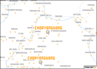
Nearby towns ::
Ki-dong (0.9km south west) //
Chŏl-gol (2.9km south west) //
Sojak-tong (3.3km north east) //
Ch'ŏnje-gol (2.8km east) //
Samp'o (2.9km west) //
Pyŏngp'ung-dong (3.0km east) //
Pyŏngp'ung-dong (4.0km north east) //
Ch'ilsŏngam (4.5km south east) //
Taosadŭk-tong (5.1km north east) //
Sobakha (6.1km north) //
Sosae-gol (6.0km south) //
Such'im-dong (4.7km west) //
Koch'angp'yŏng (4.6km west) //
Parkch'ŏl-li (6.3km north) //
Sadŭkp'yŏng (6.0km north east) //
Kop'also (5.0km west) //
Tonae (5.1km west) //
Songp'yong (5.4km south west) //
Koch'angdŏk (5.3km west) //
Suhwa-dong (5.8km north west) //
Munam-ni (6.2km north west) //
Tarimok (6.6km north east) //
Ilso (6.8km north west) //
Nŭnggok (7.1km north) //
Yŏnsu-ri (5.9km south west) //
Samdŏk (6.1km west) //
Sangch'angp'yŏng (8.4km north) //
Sinp'yŏng (8.4km south) //
Namsŏkkok (8.9km north west) //
[all distances 'as the bird flies' and approximate] 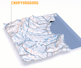 Places with similar names to Ch'op'yŏng-dong, Korea, North ::
// Ch'op'yŏng-dong (KP)
// Ch'up'yŏng-dong (KP)
// Chep'yŏng-dong (KR)
// Ch'op'yong-dong (KP)
// Ch'up'yŏng-dong (KP)
Disclaimer :: Information on this page comes without warranty of any kind |
||
|
Where is Ch'op'yŏng-dong? Elevation and coordinates ::
Latitude (lat): 41°59'26"N Longitude (lon): 129°8'58"E
Elevation (approx.): 838m (map arrows pan, magnifying glasses zoom) |
||
|
Visiting Ch'op'yŏng-dong? Hotel/Accommodation ::
Book a hotel in Ch'op'yŏng-dong Travel Guide ::
rental cars ::
car rental offers GPS waypoint ::
download a GPX waypoint (PoI) of Ch'op'yŏng-dong for your GPS receiver
|
||