|
search place name
|
||
Ch'ŏryŏn-dong (Hamgyŏng, Korea, North)Ch'ŏryŏn-dong is a town in the Hamgyŏng region of Korea, North. An overview map of the region around Ch'ŏryŏn-dong is displayed below.
regional and 3d topo map of Ch'ŏryŏn-dong, Korea, North ::
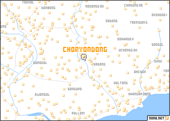
Nearby towns ::
Yangch'ol-li (0.7km east) //
Sangnyŏn-dong (1.0km east) //
Masan-dong (1.1km west) //
Chungp'yŏng-dong (1.5km north) //
Haryŏn-dong (1.3km south east) //
Changdŏng-ni (1.5km north west) //
Ch'angdŏk-tong (1.7km south west) //
Nongp'yŏng-dong (1.7km east) //
Tangu-dong (2.3km south) //
Tot'ae-dong (2.7km north) //
Sangdok-tong (2.6km south west) //
Sŏkhyŏl-li (2.9km south) //
Wayŏn-dong (2.8km south east) //
Sansŏ-dong (2.6km north east) //
Naesu-dong (3.0km north west) //
Ch'ŏnŭi-dong (2.7km west) //
Pomak-tong (3.7km south) //
Sa-dong (3.2km south east) //
Simp'o-dong (3.9km north) //
Oktang-dong (4.0km south) //
Chungdok-tong (3.5km south west) //
Chungp'yŏng-ni (3.6km north west) //
Nami-dong (3.5km south west) //
Songnae-dong (4.3km north) //
Susŏ-dong (4.4km south) //
Hagang-dong (3.5km west) //
Kajang-dong (4.2km south east) //
So-dong (4.8km north) //
Hanp'o-dong (4.1km north east) //
[all distances 'as the bird flies' and approximate] 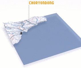 Places with similar names to Ch'ŏryŏn-dong, Korea, North :: Disclaimer :: Information on this page comes without warranty of any kind |
||
|
Where is Ch'ŏryŏn-dong? Elevation and coordinates ::
Latitude (lat): 40°54'2"N Longitude (lon): 129°26'6"E
Elevation (approx.): 40m (map arrows pan, magnifying glasses zoom) |
||
|
Visiting Ch'ŏryŏn-dong? Hotel/Accommodation ::
Book a hotel in Ch'ŏryŏn-dong Travel Guide ::
rental cars ::
car rental offers GPS waypoint ::
download a GPX waypoint (PoI) of Ch'ŏryŏn-dong for your GPS receiver
|
||