|
search place name
|
||
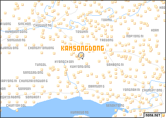
Kamsŏng-dong (Hwanghae, Korea, North)Kamsŏng-dong is a town in the Hwanghae region of Korea, North. An overview map of the region around Kamsŏng-dong is displayed below.
regional and 3d topo map of Kamsŏng-dong, Korea, North ::
Kamsŏng-dong airports ::
The nearest airport is FNJ - Pyongyang Intl, located 124.3 km north of Kamsŏng-dong.
Other airports nearby include GMP - Seoul Gimpo (156.9 km south east), SSN - Seoul East Seoul Ab (188.1 km south east), OSN - Osan Ab (202.3 km south east), Nearby towns ::
Sŏjae-dong (0.8km west) //
Tongch'on-dong (1.2km south east) //
Hagan-dong (1.2km north west) //
Nangu-dong (1.4km north west) //
Hajŏgam (2.0km north east) //
Chisŏk-tong (2.3km north) //
Nakhŭng-ni (2.2km north west) //
Sŏgu-dong (2.3km north west) //
Saehyŏn (2.5km north east) //
Kuhyŏn-dong (2.9km south) //
Sŏkchang-ni (3.0km north) //
Kŏn'gye-dong (3.1km south) //
Yŏnbong-dong (3.3km north) //
Najang-dong (3.4km north) //
Taeryong-dong (3.7km north) //
Kŭngnang-ni (2.9km east) //
Sangsegyo (3.5km north west) //
Obong (3.8km south) //
Muryŏn-dong (3.5km north east) //
Sŏjae-dong (3.8km south east) //
Tang-gol (4.0km south west) //
Sangmayu-dong (3.9km north west) //
Hyangch'o-ri (3.6km south west) //
Ch'ahyŏn-dong (3.8km south west) //
Chungmayu-dong (4.1km north west) //
Hach'ŏnsa (3.7km north west) //
Pan'gok-tong (4.5km south) //
Oryu-dong (4.0km east) //
Sangch'o-dong (4.4km south west) //
[all distances 'as the bird flies' and approximate] 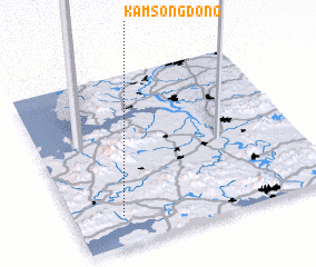 Places with similar names to Kamsŏng-dong, Korea, North ::
// Kamsaongtenga (BF)
// Kamsang-dong (KP)
// Kamsang-dong (KP)
// Kŭmsang-dong (KP)
// Kŭmsŏng-dong (KP)
// Kŭmsong-dong (KP)
// Kŭmsang-dong (KR)
// Komusan 2-dong (KP)
// Kŭmsŏng-dong (KP)
Disclaimer :: Information on this page comes without warranty of any kind |
||
|
Where is Kamsŏng-dong? Elevation and coordinates ::
Latitude (lat): 38°10'16"N Longitude (lon): 125°11'1"E
Elevation (approx.): 72m (map arrows pan, magnifying glasses zoom) |
||
|
Visiting Kamsŏng-dong? Hotel/Accommodation ::
Book a hotel in Kamsŏng-dong Travel Guide ::
rental cars ::
car rental offers GPS waypoint ::
download a GPX waypoint (PoI) of Kamsŏng-dong for your GPS receiver
|
||