|
search place name
|
||
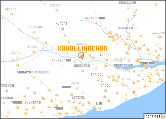
Kawŏlliha-ch'on (Hamgyŏng, Korea, North)Kawŏlliha-ch'on is a town in the Hamgyŏng region of Korea, North. An overview map of the region around Kawŏlliha-ch'on is displayed below.
regional and 3d topo map of Kawŏlliha-ch'on, Korea, North ::
Nearby towns ::
Kawŏl-li (0.9km north west) //
Kaejang-ni (1.4km north east) //
Sŏng-gol (1.9km north) //
Chwayŏngniha-ch'on (1.5km west) //
K'ŭn-gol (2.2km north) //
Yongdŏng-ni (2.1km north west) //
Ch'odu (1.8km east) //
Wŏnsal-li (1.9km south east) //
Wonp'yŏng (2.5km south) //
Pau-ch'on (2.9km south east) //
Chang-gol (3.1km south east) //
Tŏk-kol (3.4km north east) //
Ssangnyong-ni (3.2km north west) //
Chwayŏng-ni (3.8km west) //
Wŏndong-ni (4.8km north west) //
Ha-ch'on (4.1km east) //
Tok-kol (4.0km east) //
Sangmi-gol (5.1km south east) //
Tari-gol (5.2km south east) //
K'ŭn-gol (5.8km south east) //
Sa-gol (6.5km south) //
Saebat (6.5km north west) //
Nodong-ni (5.9km south east) //
Ssangsang-ni (5.9km north west) //
Yŏngt'ŏ-gol (7.5km south) //
Sinhŭng-ch'on (5.7km east) //
Yang-ch'on (6.3km south east) //
Yangp'yŏng-ni (6.9km north east) //
Tok-kol (7.8km south) //
[all distances 'as the bird flies' and approximate] 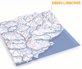 Places with similar names to Kawŏlliha-ch'on, Korea, North :: Disclaimer :: Information on this page comes without warranty of any kind |
||
|
Where is Kawŏlliha-ch'on? Elevation and coordinates ::
Latitude (lat): 40°27'1"N Longitude (lon): 128°44'48"E
Elevation (approx.): 72m (map arrows pan, magnifying glasses zoom) |
||
|
Visiting Kawŏlliha-ch'on? Hotel/Accommodation ::
Book a hotel in Kawŏlliha-ch'on Travel Guide ::
rental cars ::
car rental offers GPS waypoint ::
download a GPX waypoint (PoI) of Kawŏlliha-ch'on for your GPS receiver
|
||