|
search place name
|
||
Kwanghŭng (Hamgyŏng, Korea, North)Kwanghŭng is a town in the Hamgyŏng region of Korea, North. An overview map of the region around Kwanghŭng is displayed below.
regional and 3d topo map of Kwanghŭng, Korea, North ::
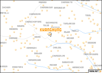
Nearby towns ::
Pongjŏn-dong (1.3km north west) //
Ch'a-dong (2.2km south east) //
Simgadŏk (2.6km north east) //
Suhoech'ŏng (2.6km north east) //
Sang-ch'on (3.2km south) //
Tolgo (3.2km north west) //
Such'im-dong (4.0km north) //
Ha-ch'on (4.0km south) //
Kiwat'ŏ (3.1km east) //
Chaet'ŏ (3.1km east) //
Pojŏn (3.6km east) //
Hakp'o (3.8km west) //
Samsu-dong (5.3km south) //
Hanch'amsu-dong (5.1km north east) //
Chŏl-gol (5.6km south) //
Onch'ŏn-dong (4.7km south east) //
Kobo (5.0km north west) //
P'ojŏn (4.7km east) //
Somaebong (4.9km west) //
Chinbŏm-dong (5.0km west) //
Chŏnjang (5.5km east) //
Kip'ŭn'gae (6.5km south west) //
Sech'ŏl-li (5.7km east) //
Yongyŏn-dong (7.4km south) //
Ha-ch'on (5.8km east) //
Chungch'op'yŏng (6.4km north west) //
Tŭngjaegŏi (6.4km north east) //
Anmin-dong (6.6km south east) //
Hong-ch'on (6.4km south west) //
[all distances 'as the bird flies' and approximate] 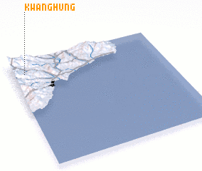 Places with similar names to Kwanghŭng, Korea, North ::
// Kwang-höng (MM)
Disclaimer :: Information on this page comes without warranty of any kind |
||
|
Where is Kwanghŭng? Elevation and coordinates ::
Latitude (lat): 40°52'50"N Longitude (lon): 129°4'47"E
Elevation (approx.): 379m (map arrows pan, magnifying glasses zoom) |
||
|
Visiting Kwanghŭng? Hotel/Accommodation ::
Book a hotel in Kwanghŭng Travel Guide ::
rental cars ::
car rental offers GPS waypoint ::
download a GPX waypoint (PoI) of Kwanghŭng for your GPS receiver
|
||