|
search place name
|
||
P'allyŏng-dong (Hamgyŏng, Korea, North)P'allyŏng-dong is a town in the Hamgyŏng region of Korea, North. An overview map of the region around P'allyŏng-dong is displayed below.
regional and 3d topo map of P'allyŏng-dong, Korea, North ::

Nearby towns ::
P'yŏngdŏgi (1.4km north) //
So-dong (1.4km south) //
Namsŏk-tong (1.3km south east) //
Tae-dong (1.3km north east) //
Yŏndŏng-ni (1.8km north east) //
Kuŏk-tong (1.8km north east) //
Simp'o-dong (2.3km south) //
Namsŏk-ch'on (2.0km north west) //
Songnae-dong (2.4km south west) //
Chŏl-gol (3.0km north) //
Yŏngjŏ-dong (2.4km south east) //
Taho-ri (3.2km north) //
Waudŏgi (3.1km north west) //
Naktong-ni (2.7km east) //
Tapki-dong (2.7km north west) //
Waudŏk (3.4km north west) //
Chi-dong (3.0km south west) //
Tot'ae-dong (3.6km south) //
Chungp'yŏng (3.1km north west) //
Paegiltŏk (3.0km west) //
Tapp'o (3.1km west) //
Suran-dong (3.5km south east) //
Naesu-dong (3.9km south west) //
Sŏnbawi (4.1km north) //
Yongho-dong (3.3km west) //
Nŭptŏk (4.4km north) //
Masal-li (4.0km north west) //
Paeksam (4.3km north west) //
Yangp'o (3.8km north west) //
[all distances 'as the bird flies' and approximate] 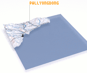 Places with similar names to P'allyŏng-dong, Korea, North ::
// Pallyong-dong (KP)
// Pallyong-dong (KP)
Disclaimer :: Information on this page comes without warranty of any kind |
||
|
Where is P'allyŏng-dong? Elevation and coordinates ::
Latitude (lat): 40°57'23"N Longitude (lon): 129°26'5"E
Elevation (approx.): 200m (map arrows pan, magnifying glasses zoom) |
||
|
Visiting P'allyŏng-dong? Hotel/Accommodation ::
Book a hotel in P'allyŏng-dong Travel Guide ::
rental cars ::
car rental offers GPS waypoint ::
download a GPX waypoint (PoI) of P'allyŏng-dong for your GPS receiver
|
||