|
search place name
|
||
Sanyang-ni (Kangwŏn, Korea, North)Sanyang-ni is a town in the Kangwŏn region of Korea, North. An overview map of the region around Sanyang-ni is displayed below.
regional and 3d topo map of Sanyang-ni, Korea, North ::

Sanyang-ni airports ::
The nearest airport is SHO - Sokch'o Sokcho, located 135.7 km south east of Sanyang-ni.
Other airports nearby include FNJ - Pyongyang Intl (149.7 km west), GMP - Seoul Gimpo (151.3 km south), SSN - Seoul East Seoul Ab (157.3 km south), KAG - Kangnung Gangneung (186.4 km south east), Nearby towns ::
Chukkŭn-ni (5.3km north) //
Chongja-ri (5.2km north east) //
Sŏkkyo-ri (5.8km south east) //
Chuk-ch'on (7.1km north) //
Hyŏkch'ang-ni (6.1km east) //
Kŭmgi-ri (6.2km east) //
Chillang-dong (7.3km south east) //
Kŭmch'ŏn-ni (7.1km south east) //
Samga-ri (7.6km north west) //
Yangsa-ri (7.8km north east) //
Chaech'ŏn-ni (8.3km south east) //
Tongga-dong (9.0km south east) //
Hasa-ri (8.9km north east) //
[all distances 'as the bird flies' and approximate] 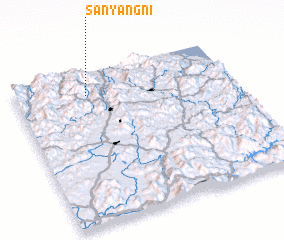 Places with similar names to Sanyang-ni, Korea, North ::
// Sanyang-ni (KP)
// Sanyang-ni (KP)
// Sanyang-ni (KP)
// Sanyang-ni (KP)
// Sanyang-ni (KP)
// Sinyang-ni (KP)
// Sinyang-ni (KP)
// Sinyang-ni (KP)
// Sinyang-ni (KP)
// Sinyang-ni (KP)
Disclaimer :: Information on this page comes without warranty of any kind |
||
|
Where is Sanyang-ni? Elevation and coordinates ::
Latitude (lat): 38°51'10"N Longitude (lon): 127°19'58"E
Elevation (approx.): 394m (map arrows pan, magnifying glasses zoom) |
||
|
Visiting Sanyang-ni? Hotel/Accommodation ::
Book a hotel in Sanyang-ni Travel Guide ::
rental cars ::
car rental offers GPS waypoint ::
download a GPX waypoint (PoI) of Sanyang-ni for your GPS receiver
|
||