|
search place name
|
||
Sŏjŏng-dong (Kaesŏng, Korea, North)Sŏjŏng-dong is a town in the Kaesŏng region of Korea, North. An overview map of the region around Sŏjŏng-dong is displayed below.
regional and 3d topo map of Sŏjŏng-dong, Korea, North ::

Sŏjŏng-dong airports ::
The nearest airport is GMP - Seoul Gimpo, located 52.5 km south of Sŏjŏng-dong.
Other airports nearby include SSN - Seoul East Seoul Ab (73.6 km south east), OSN - Osan Ab (107.7 km south), FNJ - Pyongyang Intl (160.9 km north west), SHO - Sokch'o Sokcho (165.8 km east), Nearby towns ::
Wŏndang-ni (0.4km east) //
Man-ch'on (1.3km north east) //
Sŏam (1.7km south east) //
Yuktae-dong (1.7km south east) //
Tŏgam (1.9km south east) //
Pallyong-dong (2.2km south west) //
Chŏm-mal (2.3km north) //
Sae-mal (2.1km south east) //
Sŏam-ni (2.1km south east) //
Chung-ni (2.5km south) //
Chin'gogae (2.2km north east) //
Naengjŏng-dong (2.2km east) //
Sanjik-kol (2.7km south west) //
Koŭm-ni (2.7km north east) //
Sang-ni (2.7km north east) //
Sŏnjŏng-ni (3.3km south) //
Hahyŏn (3.2km north east) //
Sŏdumulchang (3.1km north east) //
Ippau-dong (3.5km south) //
Sŏam (3.5km south east) //
Tojang-dong (3.0km east) //
Hongnŭngnae-ch'on (3.3km south east) //
Sin-ch'on (4.3km north) //
Hakhyŏn (3.5km west) //
Onsin-dong (3.8km south east) //
Tong-ch'on (4.2km north) //
Tadae-dong (3.8km south west) //
Nulmong-ni (4.4km south) //
Pakchŏk-tong (3.8km north east) //
[all distances 'as the bird flies' and approximate] 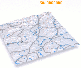 Places with similar names to Sŏjŏng-dong, Korea, North ::
// Sajang-dong (KP)
// Sajang-dong (KP)
// Sajŏng-dong (KP)
// Sajŏng-dong (KP)
// Sijŏng-dong (KP)
// Sŏjang-dong (KP)
// Sojang-dong (KP)
// Sojong-dong (KP)
// Sojung-dong (KP)
// Sujung-dong (KP)
Disclaimer :: Information on this page comes without warranty of any kind |
||
|
Where is Sŏjŏng-dong? Elevation and coordinates ::
Latitude (lat): 38°1'39"N Longitude (lon): 126°42'50"E
Elevation (approx.): 55m (map arrows pan, magnifying glasses zoom) |
||
|
Visiting Sŏjŏng-dong? Hotel/Accommodation ::
Book a hotel in Sŏjŏng-dong Travel Guide ::
rental cars ::
car rental offers GPS waypoint ::
download a GPX waypoint (PoI) of Sŏjŏng-dong for your GPS receiver
|
||