|
search place name
|
||
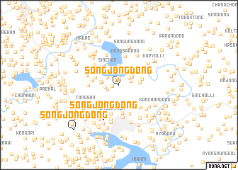
Songjŏng-dong (Hwanghae, Korea, North)Songjŏng-dong is a town in the Hwanghae region of Korea, North. An overview map of the region around Songjŏng-dong is displayed below.
regional and 3d topo map of Songjŏng-dong, Korea, North ::
Songjŏng-dong airports ::
The nearest airport is FNJ - Pyongyang Intl, located 104.0 km north of Songjŏng-dong.
Other airports nearby include GMP - Seoul Gimpo (122.3 km south east), SSN - Seoul East Seoul Ab (152.2 km south east), OSN - Osan Ab (174.5 km south east), Nearby towns ::
Sŏngja-dong (0.9km west) //
Tongnim-ni (1.2km north) //
Ŏŭn-dong (1.5km north east) //
Ch'oam-dong (1.6km south west) //
Haŏŭn (1.7km north east) //
Chungnim (1.9km north west) //
Chungdoma (1.9km north west) //
Sinjungnim (1.9km north west) //
Sangdoma (1.8km west) //
Hakchŏng-dong (2.1km north east) //
P'aryang-dong (2.1km west) //
Sŏrim-ni (2.3km west) //
Naet'o-dong (3.0km north) //
Sinsa-dong (2.6km east) //
Ch'ang-ch'on (3.4km north west) //
Sin-ch'on (3.4km north west) //
Pongo-ri (3.0km east) //
Sŏrim-ni (3.1km west) //
Sŏk-tong (3.6km south west) //
Sinjŏn-dong (3.4km west) //
Kangch'on-dong (4.5km south) //
Nongsa-dong (4.6km north) //
Tongbakkok (4.6km south) //
Ura-dong (4.0km north west) //
Kwanjŏk-tong (3.8km west) //
Taech'ŏn-dong (4.7km south) //
Tongsan-dong (4.5km south east) //
Siksŏng-ni (4.3km north west) //
Yongso-dong (4.4km north west) //
[all distances 'as the bird flies' and approximate] 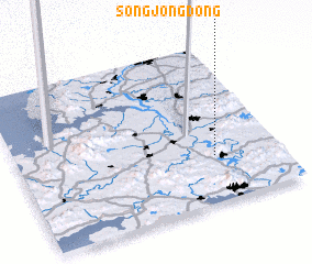 Places with similar names to Songjŏng-dong, Korea, North ::
// Sangjang-dong (KP)
// Sangjang-dong (KP)
// Sangjang-dong (KP)
// Sangjang-dong (KP)
// Sangjŏng-dong (KP)
// Sangjŭng-dong (KP)
// Sangjung-dong (KP)
// Sŏngjang-dong (KP)
// Songjŏng-dong (KP)
// Songjŏng-dong (KP)
Disclaimer :: Information on this page comes without warranty of any kind |
||
|
Where is Songjŏng-dong? Elevation and coordinates ::
Latitude (lat): 38°17'22"N Longitude (lon): 125°45'0"E
Elevation (approx.): 71m (map arrows pan, magnifying glasses zoom) |
||
|
Visiting Songjŏng-dong? Hotel/Accommodation ::
Book a hotel in Songjŏng-dong Travel Guide ::
rental cars ::
car rental offers GPS waypoint ::
download a GPX waypoint (PoI) of Songjŏng-dong for your GPS receiver
|
||