|
search place name
|
||
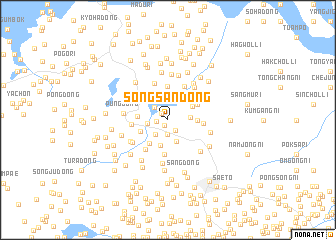
Sŏngsan-dong (Hwanghae, Korea, North)Sŏngsan-dong is a town in the Hwanghae region of Korea, North. An overview map of the region around Sŏngsan-dong is displayed below.
regional and 3d topo map of Sŏngsan-dong, Korea, North ::
Sŏngsan-dong airports ::
The nearest airport is FNJ - Pyongyang Intl, located 75.3 km north of Sŏngsan-dong.
Other airports nearby include GMP - Seoul Gimpo (162.2 km south east), SSN - Seoul East Seoul Ab (191.7 km south east), OSN - Osan Ab (214.7 km south east), Nearby towns ::
Anbong-dong (0.7km south west) //
Chŏngch'on (0.9km north west) //
Nagu-dong (1.0km west) //
Ch'ach'on (1.3km south east) //
Ŏŭl-tong (1.6km south) //
T'aengsŏk-tong (1.9km north west) //
Sangp'yŏng-dong (2.0km south west) //
Sŏrhyŏn-dong (2.2km north) //
Ŭnch'ŏn-ŭp (1.9km west) //
Ch'ang-dong (2.0km east) //
Saam-dong (2.5km south) //
Nae-dong (2.9km south) //
Sinch'ang-ni (2.6km north east) //
Sinch'on (2.6km east) //
Sin'gi-dong (3.1km south west) //
Hat'an-dong (2.7km west) //
Kungch'on (2.8km south west) //
Chŏngdong-ni (3.1km north east) //
T'ogi-dong (3.8km north) //
Hap'yŏng-dong (3.8km south) //
Sanghŭng-ni (3.1km east) //
Mun-dong (3.2km west) //
Yakpong-ni (3.8km south west) //
Un'gol-tong (4.0km north) //
Namsal-li (4.3km north) //
Sŏryong-dong (4.3km north east) //
Oedok-tong (4.0km south west) //
Tŏgyang-ni (4.1km south west) //
Yŏn'gong-ni (4.8km south) //
[all distances 'as the bird flies' and approximate]  Places with similar names to Sŏngsan-dong, Korea, North ::
// Sangsan-dong (KP)
// Sangsan-dong (KP)
// Sangsan-dong (KP)
// Sangsan-dong (KP)
// Sangsan-dong (KP)
// Sangsan-dong (KP)
// Sangsan-dong (KP)
// Sangsan-dong (KP)
// Sangsin-dong (KP)
// Sangsin-dong (KP)
Disclaimer :: Information on this page comes without warranty of any kind |
||
|
Where is Sŏngsan-dong? Elevation and coordinates ::
Latitude (lat): 38°34'3"N Longitude (lon): 125°27'14"E
Elevation (approx.): 49m (map arrows pan, magnifying glasses zoom) |
||
|
Visiting Sŏngsan-dong? Hotel/Accommodation ::
Book a hotel in Sŏngsan-dong Travel Guide ::
rental cars ::
car rental offers GPS waypoint ::
download a GPX waypoint (PoI) of Sŏngsan-dong for your GPS receiver
|
||