|
search place name
|
||
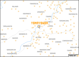
Yŏmnyŏwŏn (P'yŏngan, Korea, North)Yŏmnyŏwŏn is a town in the P'yŏngan region of Korea, North. An overview map of the region around Yŏmnyŏwŏn is displayed below.
regional and 3d topo map of Yŏmnyŏwŏn, Korea, North ::
Yŏmnyŏwŏn airports ::
The nearest airport is FNJ - Pyongyang Intl, located 79.7 km south west of Yŏmnyŏwŏn.
Nearby towns ::
Ŏha-dong (1.3km north east) //
Kujang-ŭp (1.9km south) //
Kwangdae-dong (1.7km south east) //
Ŏch'ang (2.3km north) //
Pangmakch'am (2.1km north west) //
Songjang (2.6km south) //
Tongsangch'am (2.5km south east) //
Ŏryongp'o (2.5km north east) //
Kamak-kol (2.9km north) //
Yongduch'am (2.3km west) //
Sŏnsach'am (2.4km south west) //
Unhakch'am (3.5km south) //
Sugu-ri (2.7km west) //
Chung-dong (3.2km east) //
Manhak-kol (3.7km south west) //
Tŭngnim-nodongjagu (3.9km south east) //
Tari-gol (4.4km south) //
Sŏksa-gol (4.3km south west) //
Yongch'ŏl-li (3.9km north east) //
Kŭm-gol (4.0km north east) //
Unhŭng-ni (3.9km east) //
Kajangch'am (5.0km south) //
Yongyŏl-li (4.8km north east) //
Ok-tong (5.3km south) //
Ansim-gol (4.6km south east) //
Wa-dong (5.4km north) //
Yongdŭng-nodongjagu (5.0km south east) //
Un-gol (4.3km east) //
Mokpŏl-li (5.6km south) //
[all distances 'as the bird flies' and approximate] 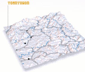 Places with similar names to Yŏmnyŏwŏn, Korea, North :: Disclaimer :: Information on this page comes without warranty of any kind |
||
|
Where is Yŏmnyŏwŏn? Elevation and coordinates ::
Latitude (lat): 39°53'1"N Longitude (lon): 126°2'7"E
Elevation (approx.): 81m (map arrows pan, magnifying glasses zoom) |
||
|
Visiting Yŏmnyŏwŏn? Hotel/Accommodation ::
Book a hotel in Yŏmnyŏwŏn Travel Guide ::
rental cars ::
car rental offers GPS waypoint ::
download a GPX waypoint (PoI) of Yŏmnyŏwŏn for your GPS receiver
|
||