|
search place name
|
||
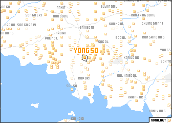
Yŏngsŏ (P'yŏngan, Korea, North)Yŏngsŏ is a town in the P'yŏngan region of Korea, North. An overview map of the region around Yŏngsŏ is displayed below.
regional and 3d topo map of Yŏngsŏ, Korea, North ::
Yŏngsŏ airports ::
The nearest airport is FNJ - Pyongyang Intl, located 84.0 km south east of Yŏngsŏ.
Nearby towns ::
Yŏng-dong (0.5km south east) //
Namch'ang (0.8km east) //
So-dong (1.0km north east) //
Soch'ŏng (0.9km north west) //
Musang-ni (1.1km north) //
Ch'usang-ni (1.1km south west) //
Kunhyŏl-li (1.4km south) //
Samsŏng-ni (1.5km south) //
Kobu-ri (1.3km east) //
Sŏ-gol (1.7km north) //
Yŏnjŏng-ni (1.9km south) //
Nam-dong (1.9km north) //
Tae-dong (1.6km north east) //
Saemal (2.2km north west) //
Musong-ni (2.4km south) //
Haso-ri (2.0km west) //
Yebong-dong (2.3km north east) //
Sagot-tong (2.4km north east) //
Sim-ch'on (2.6km north east) //
Chaegung-dong (2.6km north west) //
Sangdan (2.2km west) //
Koch'on (2.4km west) //
Puk-tong (3.0km north) //
Puyang-ni (3.1km south) //
Ch'o-dong (2.5km east) //
Sambong-ni (2.7km south west) //
Sangdan (3.5km north) //
Kŏnsan-dong (3.0km south west) //
K'ŭn-gol (2.7km east) //
[all distances 'as the bird flies' and approximate] 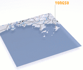 Places with similar names to Yŏngsŏ, Korea, North ::
Disclaimer :: Information on this page comes without warranty of any kind |
||
|
Where is Yŏngsŏ? Elevation and coordinates ::
Latitude (lat): 39°43'8"N Longitude (lon): 124°55'53"E
Elevation (approx.): 31m (map arrows pan, magnifying glasses zoom) |
||
|
Visiting Yŏngsŏ? Hotel/Accommodation ::
Book a hotel in Yŏngsŏ Travel Guide ::
rental cars ::
car rental offers GPS waypoint ::
download a GPX waypoint (PoI) of Yŏngsŏ for your GPS receiver
|
||