|
search place name
|
||
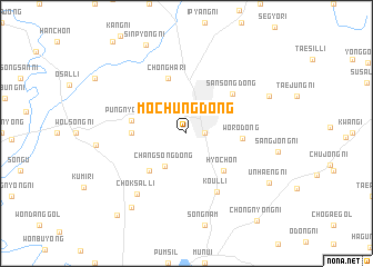
Moch'ung-dong (Ch'ungch'ŏng, Korea, South)Moch'ung-dong is a town in the Ch'ungch'ŏng region of Korea, South. An overview map of the region around Moch'ung-dong is displayed below.
regional and 3d topo map of Moch'ung-dong, Korea, South ::
Moch'ung-dong airports ::
The nearest airport is OSN - Osan Ab, located 66.4 km north west of Moch'ung-dong.
Other airports nearby include YEC - Yechon Yecheon (78.0 km east), SSN - Seoul East Seoul Ab (97.7 km north), KUB - Kunsan Ab (111.1 km south west), GMP - Seoul Gimpo (121.3 km north west), Nearby towns ::
Sayang-ni (1.5km east) //
Ch'ŏngju (2.4km north) //
Changsŏng-dong (3.7km south west) //
Kongsu-gol (4.8km south west) //
Hyoch'on (4.8km south east) //
Pansong (4.5km west) //
Wŏro-dong (4.5km east) //
P'ungnyŏn-gol (4.6km west) //
Chŏngha-ri (5.8km north) //
Sansŏng-dong (5.5km north east) //
Koŭl-li (6.4km south east) //
Ch'ŏksal-li (7.3km south west) //
Hyŏnam-ni (7.6km north east) //
Taman (8.7km south west) //
Ŭnhaeng-ni (8.3km south east) //
Sinp'yŏng-ni (9.4km north) //
Oech'ŏl-li (9.9km south west) //
Ch'ŏngnyong-ni (10.5km south east) //
[all distances 'as the bird flies' and approximate] 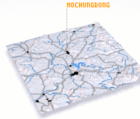 Places with similar names to Moch'ung-dong, Korea, South ::
// Machangting (MM)
Disclaimer :: Information on this page comes without warranty of any kind |
||
|
Where is Moch'ung-dong? Elevation and coordinates ::
Latitude (lat): 36°37'0"N Longitude (lon): 127°29'0"E
Elevation (approx.): 54m (map arrows pan, magnifying glasses zoom) |
||
|
Visiting Moch'ung-dong? Hotel/Accommodation ::
Book a hotel in Moch'ung-dong Travel Guide ::
rental cars ::
car rental offers GPS waypoint ::
download a GPX waypoint (PoI) of Moch'ung-dong for your GPS receiver
|
||