|
search place name
|
||
Ban Panglèng (Oudômxai, Laos)Ban Panglèng is a town in the Oudômxai region of Laos. An overview map of the region around Ban Panglèng is displayed below.
regional and 3d topo map of Ban Panglèng, Laos ::
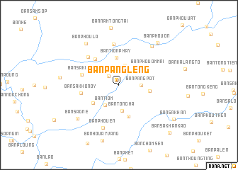
Ban Panglèng airports ::
The nearest airport is LPQ - Luang Prabang Luang Phabang Intl, located 109.8 km south east of Ban Panglèng.
Other airports nearby include THL - Tachilek Tachileik (174.2 km west), KET - Kengtung (212.5 km west), Nearby towns ::
Ban Pangkhoay (2.1km north west) //
Ban Môknamtôn (3.2km north) //
Ban Pangpot (3.3km east) //
Ban Tiom (3.8km south west) //
Ban Tôngha (4.1km south) //
Ban Tiom Phay (4.3km north) //
Ban Phoukét (4.6km east) //
Ban Tao (4.8km south west) //
Ban Phou Tang (5.2km south) //
Ban Phouôm-Mai (5.0km north east) //
Ban Môkkalam (5.4km north west) //
Ban Sakoua (5.7km west) //
Ban Sakho Noy (5.7km west) //
Ban Houayha (6.5km north) //
Ban Namxè (6.4km north west) //
Ban Phouèn (7.2km south) //
Ban Na Hé (7.8km north east) //
Ban Phoula (8.1km north west) //
Ban Sagnè (8.1km south west) //
Ban Phouôn (8.8km north east) //
Ban Houayvang (9.1km south) //
Ban Sakhan (9.8km south east) //
Ban Sakhan-Kao (10.6km south east) //
[all distances 'as the bird flies' and approximate] 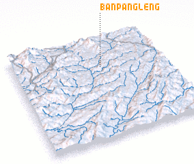 Places with similar names to Ban Panglèng, Laos ::
// Ban Pang Lang (TH)
// Ban Pang Luang (TH)
// Ban Piang Luang (TH)
// Ban Piang Luang (TH)
// Ban Ping Luang (TH)
// Ban Pong Liang (TH)
// Ban Pong Luang (TH)
// Ban Pong Luang (TH)
// Ban Pongling (LA)
// Ban Poungléng (LA)
Disclaimer :: Information on this page comes without warranty of any kind |
||
|
Where is Ban Panglèng? Elevation and coordinates ::
Latitude (lat): 20°43'42"N Longitude (lon): 101°35'12"E
Elevation (approx.): 759m (map arrows pan, magnifying glasses zoom) |
||
|
Visiting Ban Panglèng? Hotel/Accommodation ::
Book a hotel in Ban Panglèng Travel Guide ::
Buy a travel guide for Laos rental cars ::
car rental offers GPS waypoint ::
download a GPX waypoint (PoI) of Ban Panglèng for your GPS receiver
|
||