|
search place name
|
||
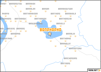
Ban Phaphô (Laos)Ban Phaphô is a town in Laos. An overview map of the region around Ban Phaphô is displayed below.
regional and 3d topo map of Ban Phaphô, Laos ::
Ban Phaphô airports ::
The nearest airport is PKZ - Pakse, located 54.8 km north west of Ban Phaphô.
Other airports nearby include ZVK - Savannakhet (246.7 km north west), Nearby towns ::
Ban Phoungam (1.9km south) //
Ban Phakkha (1.9km south) //
Ban Koutsanè (4.1km south east) //
Ban Kélè (5.2km north east) //
Ban Phômmalu (5.6km north) //
Ban Thaphô (5.7km east) //
Ban Bôk (6.5km south east) //
Ban Phalay (6.5km south east) //
Ban Thapsok (6.6km north west) //
Ban Kian-Ngông (6.5km north west) //
Ban Changhouay (7.2km east) //
Ban Nalai (7.2km east) //
Ban Thông (7.6km north) //
Ban Thôngxai (7.7km north east) //
Ban Saming (8.2km north east) //
Ban Houaykô (9.2km north west) //
Ban Thamaksan (10.3km north west) //
Ban Nakala (10.3km north east) //
[all distances 'as the bird flies' and approximate]  Places with similar names to Ban Phaphô, Laos ::
// Ban Phae (5) (TH)
// Ban Pha Pha (TH)
// Benvoghe (GA)
// Ban Na Pha Fa (LA)
// Ban Phapheu (LA)
// Ban Phapheu (LA)
// Ban Phavi (LA)
// Ban Pho Feui (LA)
// Ban Pho Pha (LA)
// Ban Phophiou (LA)
Disclaimer :: Information on this page comes without warranty of any kind |
||
|
Where is Ban Phaphô? Elevation and coordinates ::
Latitude (lat): 14°44'0"N Longitude (lon): 106°5'0"E
Elevation (approx.): 158m (map arrows pan, magnifying glasses zoom) |
||
|
Visiting Ban Phaphô? Hotel/Accommodation ::
Book a hotel in Ban Phaphô Travel Guide ::
Buy a travel guide for Laos rental cars ::
car rental offers GPS waypoint ::
download a GPX waypoint (PoI) of Ban Phaphô for your GPS receiver
|
||