|
search place name
|
||
Ban Xot (Laos)Ban Xot is a town in Laos. An overview map of the region around Ban Xot is displayed below.
regional and 3d topo map of Ban Xot, Laos ::

Ban Xot airports ::
The nearest airport is SNO - Sakon Nakhon, located 109.4 km south of Ban Xot.
Other airports nearby include VTE - Vientiane Wattay Intl (162.3 km west), UTH - Udon Thani (163.2 km south west), ZVK - Savannakhet (193.8 km south), LPQ - Luang Prabang Luang Phabang Intl (277.4 km north west), Nearby towns ::
Ban Thakanthin (1.8km east) //
Ban Nong Bo (2.8km south west) //
Ban Lao Mak Phang (3.7km south) //
Ban Khok Kwang (3.9km north west) //
Ban Hat Hae (5.1km north west) //
Ban Naphiang (5.3km east) //
Ban Sômsanouk (5.8km north) //
Ban Tha Dok Kham (5.8km south) //
Ban Nong Saeng (6.6km south) //
Ban Samphon (7.2km north west) //
Thông Nagnai (7.4km north) //
Ban Khonkhoang (8.2km south east) //
Bang Bung Chang (8.2km north west) //
Ban Tha Rai (8.5km south) //
Ban Som Hong (9.1km north west) //
[all distances 'as the bird flies' and approximate] 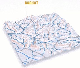 Places with similar names to Ban Xot, Laos ::
// Bungsud (PH)
// Ban Ka Sot (TH)
// Ban Ko Sadao (TH)
// Bon Qūzhd (IR)
// Banga Sud (CD)
// Bena-Kasadi (CD)
// Bena-Kazadi (CD)
// Ban Naxat (LA)
// Ban Xa Du (LA)
// Ban Xat (LA)
Disclaimer :: Information on this page comes without warranty of any kind |
||
|
Where is Ban Xot? Elevation and coordinates ::
Latitude (lat): 18°11'0"N Longitude (lon): 104°5'0"E
Elevation (approx.): 152m (map arrows pan, magnifying glasses zoom) |
||
|
Visiting Ban Xot? Hotel/Accommodation ::
Book a hotel in Ban Xot Travel Guide ::
Buy a travel guide for Laos rental cars ::
car rental offers GPS waypoint ::
download a GPX waypoint (PoI) of Ban Xot for your GPS receiver
|
||