|
search place name
|
||
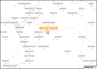
Bédékoma (Mali)Bédékoma is a town in Mali. An overview map of the region around Bédékoma is displayed below.
regional and 3d topo map of Bédékoma, Mali ::
Bédékoma airports ::
The nearest airport is KYS - Kayes Dag Dag, located 132.4 km west of Bédékoma.
Other airports nearby include SEY - Selibabi Selibady (244.5 km north west), KGG - Kedougou (266.3 km south west), Nearby towns ::
Diédia (2.6km south east) //
Sitafé (2.6km north east) //
Kobokoto (3.6km west) //
Sidiantinti (3.7km north) //
Toumbinassou (3.7km north) //
Gourouma (4.0km south west) //
Maréna (4.0km south east) //
Kintoro (4.1km north east) //
Boroka (4.0km north east) //
Fardala (5.4km west) //
Sambaguidé (5.8km south) //
Kéniéfé (7.6km north) //
Assonfri (7.7km north west) //
Tingoï (8.1km north west) //
Niankélé (8.2km north west) //
Kobodinn Koto (9.1km south west) //
Mayodan (10.3km south west) //
Wolifata (10.3km south west) //
Fassala (10.3km north west) //
Kitora (10.3km south east) //
[all distances 'as the bird flies' and approximate] 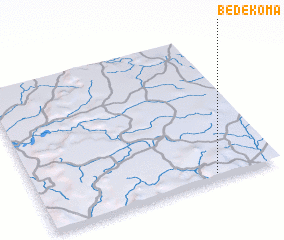 Places with similar names to Bédékoma, Mali ::
// Bettikum (DE)
// Bétokomia I (CF)
// Bétokomia II (CF)
// Bétokomia III (CF)
// Bodo-Gombo (CF)
// Bitikim (TD)
// Bétoukoumba (CG)
// Badgām (IN)
// Badgom (IN)
// Badogām (IN)
Disclaimer :: Information on this page comes without warranty of any kind |
||
|
Where is Bédékoma? Elevation and coordinates ::
Latitude (lat): 14°2'0"N Longitude (lon): 10°16'0"W
Elevation (approx.): 350m (map arrows pan, magnifying glasses zoom) |
||
|
Visiting Bédékoma? Hotel/Accommodation ::
Book a hotel in Bédékoma Travel Guide ::
Buy a travel guide for Mali rental cars ::
car rental offers GPS waypoint ::
download a GPX waypoint (PoI) of Bédékoma for your GPS receiver
|
||