|
search place name
|
||
Mudunnegama (North Central, Sri Lanka)Mudunnegama is a town in the North Central region of Sri Lanka. An overview map of the region around Mudunnegama is displayed below.
regional and 3d topo map of Mudunnegama, Sri Lanka ::

Mudunnegama airports ::
The nearest airport is TRR - Trinciomalee China Bay, located 101.1 km east of Mudunnegama.
Other airports nearby include CMB - Bandaranaike Intl Colombo (125.8 km south), RML - Colombo Ratmalana (163.2 km south), JAF - Jaffna Kankesanturai (174.5 km north), GOY - Galoya Amparai (175.2 km south east), Nearby towns ::
Karagahawewa (0.0km north) //
Doranewa (1.9km south) //
Kongollewa (1.9km south) //
Gambirigaswewa (1.8km east) //
Kongahawewa (1.9km north) //
Ratmalagahawewa (1.9km north) //
Gonungama (2.6km south east) //
Tammannewa (2.6km south east) //
Kadahatawewa (2.6km north east) //
Helambawewa (2.6km north west) //
Ihala Talawa (3.7km east) //
Malwanegama (3.7km south) //
Watupolayagama (3.7km south) //
Mirihenegama (3.7km north) //
Hirigollegama (3.7km west) //
Talawa (4.1km south east) //
Eriyagama (4.1km south east) //
Taranewa (4.1km south east) //
Payindikulama (4.1km south east) //
Hangiliya (4.1km south east) //
Moragoda (4.1km north east) //
Solanwewa (4.1km south west) //
Kelegama (4.1km south west) //
Ihala Indigaspotana (4.1km north east) //
Neluntottama (4.1km south west) //
Nawakkulama (4.1km south west) //
Yalegama (4.1km north west) //
Wetiya (4.1km north west) //
Kumbukgahawewa (4.1km north west) //
[all distances 'as the bird flies' and approximate] 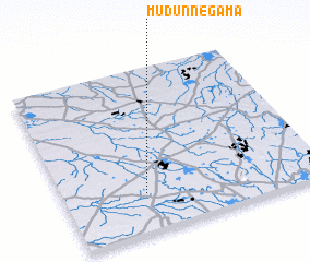 Places with similar names to Mudunnegama, Sri Lanka ::
// Mietenkam (DE)
// Matongama (LK)
// Mudunnegama (LK)
// Mutangama (ZM)
// Mbatinikama (FJ)
// Medenguma (MZ)
// Modenkema (SL)
Disclaimer :: Information on this page comes without warranty of any kind |
||
|
Where is Mudunnegama? Elevation and coordinates ::
Latitude (lat): 8°14'0"N Longitude (lon): 80°19'0"E
Elevation (approx.): 107m (map arrows pan, magnifying glasses zoom) |
||
|
Visiting Mudunnegama? Hotel/Accommodation ::
Book a hotel in Mudunnegama Travel Guide ::
Buy a travel guide for Sri Lanka rental cars ::
car rental offers GPS waypoint ::
download a GPX waypoint (PoI) of Mudunnegama for your GPS receiver
|
||