|
search place name
|
||
Kouka Bokoy (Dosso, Niger)Kouka Bokoy is a town in the Dosso region of Niger. An overview map of the region around Kouka Bokoy is displayed below.
regional and 3d topo map of Kouka Bokoy, Niger ::

Kouka Bokoy airports ::
The nearest airport is SKO - Sokoto Sadiq Abubakar Iii Intl, located 144.0 km south east of Kouka Bokoy.
Other airports nearby include THZ - Tahoua (192.8 km north east), NIM - Niamey Diori Hamani (204.1 km west), Nearby towns ::
Salé (1.9km south) //
Bangou (1.9km south) //
Guilimé Koré (3.7km south) //
Garin Bouzaé (5.4km west) //
Afolé (5.7km west) //
Kourfa Saouna (6.6km south west) //
Liguido (6.6km north east) //
Takaré (7.4km south) //
Angoal Nana (7.4km south) //
Garin Ta Anari (7.2km west) //
Garin Beydou (7.6km south) //
Dogondoutchi (8.1km north west) //
Rouda Adwa (8.2km south west) //
Gaguila (9.2km south west) //
Noufawa (10.3km south west) //
[all distances 'as the bird flies' and approximate] 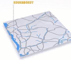 Places with similar names to Kouka Bokoy, Niger ::
// Cagabaca (PH)
// Kagabaca (PH)
// Kokobéga (BJ)
// Kougoubaga (BF)
// Koukébako (BF)
// Kokkabak (KZ)
// Koukabokoy (NE)
// Kakubuka (ZM)
// Kikoboga (TZ)
// Kakobougou (ML)
Disclaimer :: Information on this page comes without warranty of any kind |
||
|
Where is Kouka Bokoy? Elevation and coordinates ::
Latitude (lat): 13°35'0"N Longitude (lon): 4°4'0"E
Elevation (approx.): 230m (map arrows pan, magnifying glasses zoom) |
||
|
Visiting Kouka Bokoy? Hotel/Accommodation ::
Book a hotel in Kouka Bokoy Travel Guide ::
Buy a travel guide for Niger rental cars ::
car rental offers GPS waypoint ::
download a GPX waypoint (PoI) of Kouka Bokoy for your GPS receiver
|
||