|
search place name
|
||
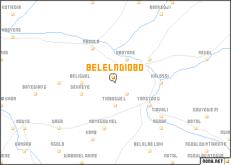
Bélel Ndiobo (Louga, Senegal)Bélel Ndiobo is a town in the Louga region of Senegal. An overview map of the region around Bélel Ndiobo is displayed below.
regional and 3d topo map of Bélel Ndiobo, Senegal ::
Bélel Ndiobo airports ::
The nearest airport is XLS - St. Louis Saint Louis, located 123.6 km north west of Bélel Ndiobo.
Other airports nearby include KLC - Kaolack (177.1 km south west), KED - Kaedi (211.4 km east), TUD - Tambacounda (280.5 km south east), Nearby towns ::
Ndiane Sabo (2.6km south east) //
Tiaboguel (3.7km south) //
Mboyane (4.1km north east) //
Béliguel (5.4km west) //
Dék Rèye (5.7km west) //
Mboula (6.6km north west) //
Mbeuleukhé (6.5km north east) //
Yang-Yang (6.5km south east) //
Kalossi (7.1km east) //
Maye Goumel (7.6km south) //
Tiavali (9.0km south east) //
Ngraf (10.3km south east) //
[all distances 'as the bird flies' and approximate] 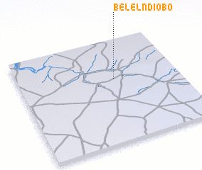 Places with similar names to Bélel Ndiobo, Senegal :: Disclaimer :: Information on this page comes without warranty of any kind |
||
|
Where is Bélel Ndiobo? Elevation and coordinates ::
Latitude (lat): 15°37'0"N Longitude (lon): 15°24'0"W
Elevation (approx.): 45m (map arrows pan, magnifying glasses zoom) |
||
|
Visiting Bélel Ndiobo? Hotel/Accommodation ::
Book a hotel in Bélel Ndiobo Travel Guide ::
Buy a travel guide for Senegal rental cars ::
car rental offers GPS waypoint ::
download a GPX waypoint (PoI) of Bélel Ndiobo for your GPS receiver
|
||