|
search place name
|
||
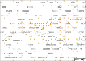
Daga Diouf (Diourbel, Senegal)Daga Diouf is a town in the Diourbel region of Senegal. An overview map of the region around Daga Diouf is displayed below.
regional and 3d topo map of Daga Diouf, Senegal ::
Daga Diouf airports ::
The nearest airport is KLC - Kaolack, located 67.0 km south of Daga Diouf.
Other airports nearby include XLS - St. Louis Saint Louis (152.3 km north), DKR - Dakar Leopold Sedar Senghor Intl (160.5 km west), BJL - Banjul Intl (171.4 km south west), Nearby towns ::
Darou Mbaké (1.8km west) //
Dèye Songo (1.8km east) //
Dala (1.9km north) //
Darou Naïm (1.9km south) //
Ndindi (2.6km south west) //
Taïba (2.6km south east) //
Lâ (2.6km north east) //
Darou Badèm (3.6km west) //
Tiale (3.7km south) //
Baki (4.1km north east) //
Taïnabé (4.0km south east) //
Ngabou (4.1km north east) //
Ngabou Mourid (4.0km north east) //
Keur Ndiaye (5.2km south west) //
Saté (5.2km north east) //
Ouarti (5.2km south east) //
Tchila (5.2km north east) //
Bangaye (5.2km south east) //
Boulel Babori (5.8km south) //
Baïti Dia (5.8km north) //
Yavène (5.7km east) //
Tioumbé (5.7km west) //
Gowane (5.8km south) //
Tièlé (5.8km south) //
Ndakar (5.7km east) //
Tiékène (6.6km south east) //
Mourtéki (6.6km south east) //
Tienti (6.5km north west) //
Kanka (6.6km north east) //
[all distances 'as the bird flies' and approximate] 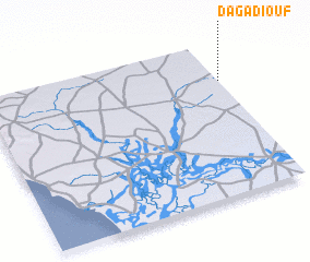 Places with similar names to Daga Diouf, Senegal ::
Disclaimer :: Information on this page comes without warranty of any kind |
||
|
Where is Daga Diouf? Elevation and coordinates ::
Latitude (lat): 14°45'0"N Longitude (lon): 16°0'0"W
Elevation (approx.): 28m (map arrows pan, magnifying glasses zoom) |
||
|
Visiting Daga Diouf? Hotel/Accommodation ::
Book a hotel in Daga Diouf Travel Guide ::
Buy a travel guide for Senegal rental cars ::
car rental offers GPS waypoint ::
download a GPX waypoint (PoI) of Daga Diouf for your GPS receiver
|
||