|
search place name
|
||
Dèm (Diourbel, Senegal)Dèm is a town in the Diourbel region of Senegal. An overview map of the region around Dèm is displayed below.
regional and 3d topo map of Dèm, Senegal ::

Dèm airports ::
The nearest airport is KLC - Kaolack, located 78.0 km south of Dèm.
Other airports nearby include XLS - St. Louis Saint Louis (138.5 km north), DKR - Dakar Leopold Sedar Senghor Intl (150.2 km west), BJL - Banjul Intl (177.6 km south), Nearby towns ::
Ndia (2.6km north west) //
Gouyanabé (2.6km north east) //
Tiak (3.7km south) //
Sam Sam (4.1km north east) //
Mbayène (5.2km south west) //
Niarhène (5.2km south east) //
Mala Diop (5.6km north) //
Dank (5.7km west) //
Darou Niaye (5.7km east) //
Gadiali (5.7km east) //
Digane (5.7km east) //
Diarhaye (5.8km north) //
Salao (6.5km north west) //
Naye (6.5km south east) //
Tièye (7.2km west) //
Ma Samba (7.6km south) //
Ndiogop (7.7km south west) //
Baodé (7.7km north west) //
Ngabou Fal (7.7km north east) //
Guélodé (8.1km north east) //
Moro Ndiaye (9.2km north west) //
Tienti (9.2km south east) //
Ndia Tako (9.2km north east) //
Tiaski (9.2km north east) //
[all distances 'as the bird flies' and approximate] 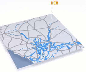 Places with similar names to Dèm, Senegal ::
Disclaimer :: Information on this page comes without warranty of any kind |
||
|
Where is Dèm? Elevation and coordinates ::
Latitude (lat): 14°51'0"N Longitude (lon): 16°6'0"W
Elevation (approx.): 42m (map arrows pan, magnifying glasses zoom) |
||
|
Visiting Dèm? Hotel/Accommodation ::
Book a hotel in Dèm Travel Guide ::
Buy a travel guide for Senegal rental cars ::
car rental offers GPS waypoint ::
download a GPX waypoint (PoI) of Dèm for your GPS receiver
|
||