|
search place name
|
||
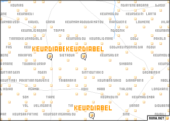
Keur Diabèl (Kaolack, Senegal)Keur Diabèl is a town in the Kaolack region of Senegal. An overview map of the region around Keur Diabèl is displayed below.
regional and 3d topo map of Keur Diabèl, Senegal ::
Keur Diabèl airports ::
The nearest airport is KLC - Kaolack, located 40.4 km north west of Keur Diabèl.
Other airports nearby include BJL - Banjul Intl (123.9 km south west), ZIG - Ziguinchor (169.4 km south), CSK - Cap Skiring (206.7 km south west), DKR - Dakar Leopold Sedar Senghor Intl (208.8 km north west), Nearby towns ::
Keur Ali Maram (1.9km south) //
Keur Paté (1.9km north) //
Keur Mala (2.6km south west) //
Keur Abdou (2.6km north west) //
Sinalla (3.7km south) //
Siét Aoua (3.6km west) //
Dimbéré (3.6km west) //
Keur Mbeïkou (3.7km north) //
Barkèdji (4.1km south east) //
Sintiou Tiako (4.1km south east) //
Keur Saïdou (4.1km north west) //
Keur Mgata Dramé (4.0km north east) //
Keur Ali Dramé (5.2km north east) //
Keur Sadèr (5.4km east) //
Keur Mamout (5.6km south) //
Keur Goumbo Guéye (5.8km north) //
Keur Séring Taïba (5.7km west) //
Malène (5.8km south) //
Keur Makar (6.5km south east) //
Ségré Sékko (6.6km north west) //
Keur Sièt Diop (6.5km south west) //
Taïba Mama (6.6km south west) //
Ndiaga (6.6km south west) //
Keur Doudi (6.5km north west) //
Keur El Adj Momat (6.5km north west) //
Koki (7.4km south) //
Keur Diâbél (7.2km west) //
Keur Mamadou Diamatou (7.4km north) //
Kéroual (7.6km south) //
[all distances 'as the bird flies' and approximate] 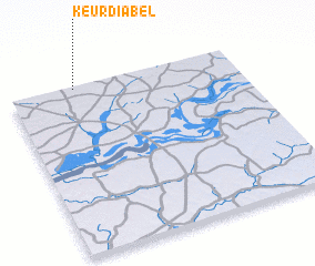 Places with similar names to Keur Diabèl, Senegal ::
// Cardabello (IT)
// Courtableau (US)
// Gartabal (IN)
// Keur Diabel (SN)
// Keur Diabel (SN)
// Keur Diabel (SN)
// Keur Diâbél (SN)
// Gūrīd-e Bālā (IR)
// Kahrūd-e Bālā (IR)
// Ker Dobaly (GM)
Disclaimer :: Information on this page comes without warranty of any kind |
||
|
Where is Keur Diabèl? Elevation and coordinates ::
Latitude (lat): 13°59'0"N Longitude (lon): 15°43'0"W
Elevation (approx.): 35m (map arrows pan, magnifying glasses zoom) |
||
|
Visiting Keur Diabèl? Hotel/Accommodation ::
Book a hotel in Keur Diabèl Travel Guide ::
Buy a travel guide for Senegal rental cars ::
car rental offers GPS waypoint ::
download a GPX waypoint (PoI) of Keur Diabèl for your GPS receiver
|
||