|
search place name
|
||
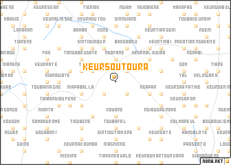
Keur Soutoura (Kaolack, Senegal)Keur Soutoura is a town in the Kaolack region of Senegal. An overview map of the region around Keur Soutoura is displayed below.
regional and 3d topo map of Keur Soutoura, Senegal ::
Keur Soutoura airports ::
The nearest airport is KLC - Kaolack, located 31.8 km north west of Keur Soutoura.
Other airports nearby include BJL - Banjul Intl (98.4 km south west), ZIG - Ziguinchor (151.7 km south), CSK - Cap Skiring (185.3 km south west), DKR - Dakar Leopold Sedar Senghor Intl (192.8 km north west), Nearby towns ::
Pakala (2.6km south east) //
Forou (2.6km south east) //
Pompone (2.6km north east) //
Keur Biram (2.6km south west) //
Ndofane (3.7km north) //
Tanda Mbar (4.0km north west) //
Kouaré (5.6km south) //
Bassabou (5.8km north) //
Ngapar (5.7km east) //
Niapa Balla (5.7km west) //
Keur Baka (5.8km north) //
Goundi (5.7km west) //
Sintiou Mamout (6.5km south west) //
Keur Malik Diao (6.5km north east) //
Keur Ama Ngoné (6.5km north east) //
Sintiou Mour (6.6km north west) //
Tanda Boudaye (6.5km north west) //
Guienté Kaye (6.6km south west) //
Touba Fal (7.4km south) //
Keur Bara (7.4km east) //
Keur Séring Oumar Ndao (7.4km east) //
Koné (7.6km north) //
Ndioubène Galo (7.4km west) //
Gobak (7.7km north east) //
Keur Mbaye Ndonk (7.7km north west) //
Layène Korédia (8.2km south east) //
Dinnguiraye (8.1km south east) //
Ganda (8.2km north east) //
Sintiou Diors (8.1km south west) //
[all distances 'as the bird flies' and approximate]  Places with similar names to Keur Soutoura, Senegal ::
// Cristo Rey (PH)
// Cristo Rey (BZ)
// Cristo Rey (BZ)
// Cruz de Oro (PA)
// Corese Terra (IT)
// Crestur (RO)
// Cristur (RO)
// Kirazdere (TR)
// Greystorie (ZA)
// Cristo Rey (CO)
Disclaimer :: Information on this page comes without warranty of any kind |
||
|
Where is Keur Soutoura? Elevation and coordinates ::
Latitude (lat): 13°53'0"N Longitude (lon): 15°56'0"W
Elevation (approx.): 22m (map arrows pan, magnifying glasses zoom) |
||
|
Visiting Keur Soutoura? Hotel/Accommodation ::
Book a hotel in Keur Soutoura Travel Guide ::
Buy a travel guide for Senegal rental cars ::
car rental offers GPS waypoint ::
download a GPX waypoint (PoI) of Keur Soutoura for your GPS receiver
|
||