|
search place name
|
||
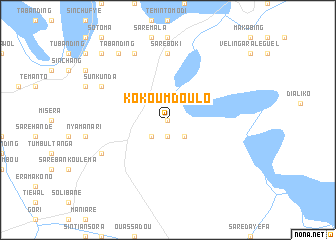
Kokoum Doulo (Kolda, Senegal)Kokoum Doulo is a town in the Kolda region of Senegal. An overview map of the region around Kokoum Doulo is displayed below.
regional and 3d topo map of Kokoum Doulo, Senegal ::
Kokoum Doulo airports ::
The nearest airport is TUD - Tambacounda, located 45.1 km north of Kokoum Doulo.
Other airports nearby include KGG - Kedougou (190.2 km south east), BXE - Bakel (218.2 km north east), BXO - Bissau Oswaldo Vieira Intl (259.2 km south west), SEY - Selibabi Selibady (264.4 km north east), Nearby towns ::
Kokoum Samba (0.0km north) //
Balokounda (1.9km south) //
Madina Kokoun (2.6km south east) //
Tamindala (2.6km south west) //
Saré Boki (7.4km north) //
Sintiân Douldé (8.1km south west) //
Karsi Kunda (8.1km north west) //
Sun Kunda (8.1km north west) //
Sare Tobi (8.2km north west) //
Madina Fula Kunda (9.2km north west) //
Niji (9.2km north west) //
Tabanding (9.2km north west) //
Madina Bala (10.3km north west) //
[all distances 'as the bird flies' and approximate]  Places with similar names to Kokoum Doulo, Senegal ::
Disclaimer :: Information on this page comes without warranty of any kind |
||
|
Where is Kokoum Doulo? Elevation and coordinates ::
Latitude (lat): 13°21'0"N Longitude (lon): 13°47'0"W
Elevation (approx.): 34m (map arrows pan, magnifying glasses zoom) |
||
|
Visiting Kokoum Doulo? Hotel/Accommodation ::
Book a hotel in Kokoum Doulo Travel Guide ::
Buy a travel guide for Senegal rental cars ::
car rental offers GPS waypoint ::
download a GPX waypoint (PoI) of Kokoum Doulo for your GPS receiver
|
||