|
search place name
|
||
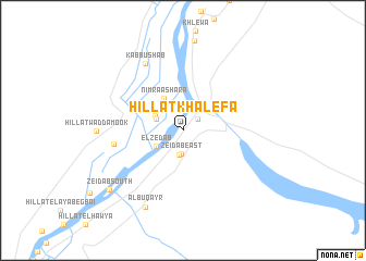
Hillat Khalefa (Nahr an Nīl, Sudan)Hillat Khalefa is a town in the Nahr an Nīl region of Sudan. An overview map of the region around Hillat Khalefa is displayed below.
regional and 3d topo map of Hillat Khalefa, Sudan ::
Hillat Khalefa airports ::
The nearest airport is KRT - Khartoum, located 247.6 km south west of Hillat Khalefa.
Nearby towns ::
Haye el ‘Arda el Mineqla (1.9km north east) //
Zeidab East (2.4km south) //
Qaryat Hamad Naalla (2.5km south) //
El ‘Aqedab (2.8km north west) //
El Zedab (3.1km south west) //
Zeidab North (3.1km north west) //
Nimra ‘Ashara (3.8km north west) //
Hillat Banat (6.9km west) //
Kabbūshāb (7.8km north west) //
Al Buqayr (8.7km south west) //
Hillat Wad Damook (8.5km west) //
Zeidāb South (9.4km south west) //
[all distances 'as the bird flies' and approximate] 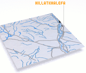 Places with similar names to Hillat Khalefa, Sudan :: Disclaimer :: Information on this page comes without warranty of any kind |
||
|
Where is Hillat Khalefa? Elevation and coordinates ::
Latitude (lat): 17°25'16"N Longitude (lon): 33°53'4"E
Elevation (approx.): 355m (map arrows pan, magnifying glasses zoom) |
||
|
Visiting Hillat Khalefa? Hotel/Accommodation ::
Book a hotel in Hillat Khalefa Travel Guide ::
Buy a travel guide for Sudan rental cars ::
car rental offers GPS waypoint ::
download a GPX waypoint (PoI) of Hillat Khalefa for your GPS receiver
|
||