|
search place name
|
||
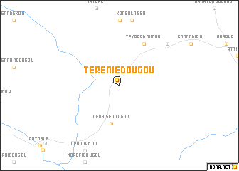
Téréniédougou (Cote d'Ivoire)Téréniédougou is a town in Cote d'Ivoire. An overview map of the region around Téréniédougou is displayed below.
regional and 3d topo map of Téréniédougou, Cote d'Ivoire ::
Téréniédougou airports ::
The nearest airport is BYK - Bouake, located 94.9 km west of Téréniédougou.
Other airports nearby include ASK - Yamoussoukro (172.1 km south west), HGO - Korhogo (210.9 km north west), NYI - Sunyani (223.2 km east), Nearby towns ::
Diembisédougou (6.1km south) //
Yeyaradougou (7.5km north east) //
Koulomia (9.9km north east) //
[all distances 'as the bird flies' and approximate]  Places with similar names to Téréniédougou, Cote d'Ivoire ::
// Triandaíika (GR)
// Dirin-Atakh (RU)
// Torandougou (BF)
// Durentiga (ID)
// Tarandacuao (MX)
// Torno dʼÁgua (CV)
Disclaimer :: Information on this page comes without warranty of any kind |
||
|
Where is Téréniédougou? Elevation and coordinates ::
Latitude (lat): 7°59'29"N Longitude (lon): 4°15'3"W
Elevation (approx.): 213m (map arrows pan, magnifying glasses zoom) |
||
|
Visiting Téréniédougou? Hotel/Accommodation ::
Book a hotel in Téréniédougou Travel Guide ::
rental cars ::
car rental offers GPS waypoint ::
download a GPX waypoint (PoI) of Téréniédougou for your GPS receiver
|
||