|
search place name
|
||
La Ferrière (Aargau, Switzerland)La Ferrière is a town in the Aargau region of Switzerland. An overview map of the region around La Ferrière is displayed below.
regional and 3d topo map of La Ferrière, Switzerland ::

La Ferrière airports ::
The nearest airport is BRN - Bern Belp, located 52.6 km south east of La Ferrière.
Other airports nearby include MLH - Bale Mulhouse (70.4 km north east), SIR - Sion (107.1 km south), DLE - Dole Tavaux (111.1 km west), CMR - Colmar Houssen (114.3 km north), Nearby towns ::
La Chaux-de-Fonds (2.5km west) //
Renan (3.1km south east) //
Les Bois (3.9km north) //
Fournet-Blancheroche (5.3km north west) //
Sonvilier (5.0km east) //
Cernier (7.5km south) //
Chézard-Saint-Martin (8.3km south east) //
Combe-Saint-Pierre (8.3km north west) //
Le Peuchapatte (9.0km north east) //
[all distances 'as the bird flies' and approximate] 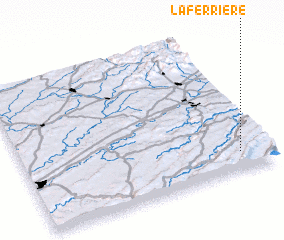 Places with similar names to La Ferrière, Switzerland ::
// La Ferrera (IT)
// Le Ferriere (IT)
// La Ferrería (ES)
// La Ferrería (CO)
// La Ferrería (MX)
// Luvuerere (MZ)
// Laférière (HT)
// La Ferrière (HT)
// La Ferrière (HT)
// Laferrière (HT)
Disclaimer :: Information on this page comes without warranty of any kind |
||
|
Where is La Ferrière? Elevation and coordinates ::
Latitude (lat): 47°8'0"N Longitude (lon): 6°53'0"E
Elevation (approx.): 1013m (map arrows pan, magnifying glasses zoom) |
||
|
Visiting La Ferrière? Hotel/Accommodation ::
Book a hotel in La Ferrière Travel Guide ::
Buy a travel guide for Switzerland rental cars ::
car rental offers GPS waypoint ::
download a GPX waypoint (PoI) of La Ferrière for your GPS receiver
|
||