|
search place name
|
||
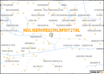
Heiligenkreuz im Lafnitztal (Burgenland, Austria)Heiligenkreuz im Lafnitztal is a town in the Burgenland region of Austria. An overview map of the region around Heiligenkreuz im Lafnitztal is displayed below.
regional and 3d topo map of Heiligenkreuz im Lafnitztal, Austria ::
Heiligenkreuz im Lafnitztal airports ::
The nearest airport is GRZ - Graz, located 62.5 km west of Heiligenkreuz im Lafnitztal.
Other airports nearby include MBX - Maribor (71.7 km south west), VIE - Vienna Schwechat (126.8 km north), ZAG - Zagreb (139.3 km south), BTS - Bratislava M R Stefanik (149.6 km north east), Nearby towns ::
Deutsch Minihof (2.4km south) //
Pfisterwald (2.6km south) //
Neustift bei Güssing (3.1km north) //
Wallendorf (2.8km south west) //
Poppendorf im Burgenland (2.9km west) //
Hochkugel (3.7km north west) //
Neuberg (4.9km north) //
Tschanigraben (4.3km north east) //
Mogersdorf (4.9km south west) //
Rosendorf (4.0km west) //
Leventehegy (4.3km east) //
Pfeiferberg (5.5km south west) //
Eltendorf (4.8km west) //
Frisch (5.2km north east) //
Inzenhof (5.2km north east) //
Fuchsgraben (6.5km north east) //
Krottendorf bei Güssing (7.4km north east) //
Szentgotthárd (6.4km south east) //
Meisterberg (7.5km north west) //
Zahling (6.7km north west) //
Maria Bild (6.4km south west) //
Szakonyfalu (8.3km south) //
Sulz im Burgenland (8.6km north) //
Steingraben (8.6km north) //
Gerersdorf bei Güssing (8.7km north) //
Alsószölnök (7.9km south west) //
Alsószölnöki Tanyák (7.7km south west) //
Kleinmürbisch (7.4km north east) //
Weichselbaum (7.6km south west) //
[all distances 'as the bird flies' and approximate] 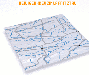 Places with similar names to Heiligenkreuz im Lafnitztal, Austria :: Disclaimer :: Information on this page comes without warranty of any kind |
||
|
Where is Heiligenkreuz im Lafnitztal? Elevation and coordinates ::
Latitude (lat): 46°59'21"N Longitude (lon): 16°15'39"E
Elevation (approx.): 243m (map arrows pan, magnifying glasses zoom) |
||
|
Visiting Heiligenkreuz im Lafnitztal? Hotel/Accommodation ::
Book a hotel in Heiligenkreuz im Lafnitztal Travel Guide ::
Buy a travel guide for Austria rental cars ::
car rental offers GPS waypoint ::
download a GPX waypoint (PoI) of Heiligenkreuz im Lafnitztal for your GPS receiver
|
||