|
search place name
|
||
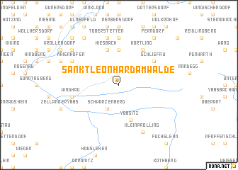
Sankt Leonhard am Walde (Niederösterreich, Austria)Sankt Leonhard am Walde is a town in the Niederösterreich region of Austria. An overview map of the region around Sankt Leonhard am Walde is displayed below.
regional and 3d topo map of Sankt Leonhard am Walde, Austria ::
nearby GPS traces from timatio ::
Sankt Leonhard am Walde airports ::
The nearest airport is LNZ - Linz (Horsching), located 57.7 km north west of Sankt Leonhard am Walde.
Other airports nearby include GRZ - Graz (118.5 km south), VIE - Vienna Schwechat (127.8 km east), SZG - Salzburg (140.9 km west), KLU - Klagenfurt (Worthersee Intl) (154.3 km south), Nearby towns ::
Schwarzenberg (3.9km south) //
Grub (5.6km north) //
Ybbsitz (5.7km south) //
Hiesbach (5.7km north) //
Hörtling (6.1km north east) //
Schliefau (5.3km north east) //
Kornberg (7.4km north) //
Windhag (5.3km west) //
Toberstetten (7.5km north) //
Neuhofen an der Ybbs (7.5km north) //
Kleinprolling (7.8km south) //
Maierhofen (6.2km north west) //
Frieberstetten (8.3km north west) //
Ferndorf (8.3km north east) //
Haag (7.5km north west) //
Fohra (7.5km north west) //
Wallmersdorf (8.9km north west) //
[all distances 'as the bird flies' and approximate] 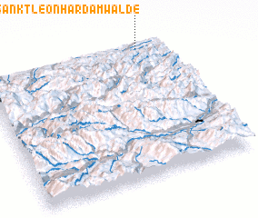 Places with similar names to Sankt Leonhard am Walde, Austria ::
// Sankt Leonhard am Wonneberg (DE)
Disclaimer :: Information on this page comes without warranty of any kind |
||
|
Where is Sankt Leonhard am Walde? Elevation and coordinates ::
Latitude (lat): 47°59'0"N Longitude (lon): 14°52'0"E
Elevation (approx.): 578m (map arrows pan, magnifying glasses zoom) |
||
|
Visiting Sankt Leonhard am Walde? Hotel/Accommodation ::
Book a hotel in Sankt Leonhard am Walde Travel Guide ::
Buy a travel guide for Austria rental cars ::
car rental offers GPS waypoint ::
download a GPX waypoint (PoI) of Sankt Leonhard am Walde for your GPS receiver
|
||