|
search place name
|
||
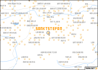
Sankt Stefan (Kärnten, Austria)Sankt Stefan is a town in the Kärnten region of Austria. An overview map of the region around Sankt Stefan is displayed below.
regional and 3d topo map of Sankt Stefan, Austria ::
Sankt Stefan airports ::
The nearest airport is KLU - Klagenfurt (Worthersee Intl), located 29.0 km west of Sankt Stefan.
Other airports nearby include LJU - Ljubliana Ljubljana (42.4 km south west), GRZ - Graz (73.6 km north east), MBX - Maribor (76.3 km east), TRS - Ronchi De Legionari Ronchi Dei Legionari (125.4 km south west), Nearby towns ::
Steben (0.0km north) //
Globasnitz (1.1km south) //
Globasnica (1.1km south) //
Tschepitschach (1.3km west) //
Čepiče (1.3km west) //
Kleindorf (1.9km south) //
Mala Ves (1.9km south) //
Wackendorf (2.2km south east) //
Večna Ves (2.2km south east) //
Traundorf (2.3km north east) //
Strpna Ves (2.3km north east) //
Loibegg (2.4km west) //
Pirkdorf (2.5km east) //
Breška Ves (2.5km east) //
Črgoviče (3.2km north east) //
Tscherberg (3.2km north east) //
Jaunstein (3.2km south west) //
Podjuna (3.2km south west) //
Podgora (3.2km south east) //
Unterbergen (3.2km south east) //
Mittlern (4.6km north) //
Sankt Michael ob Bleiburg (3.6km east) //
Smihel nad Pliberkom (3.6km east) //
Rute (4.5km north east) //
Ruttach (4.5km north east) //
Slovenjach (4.5km south west) //
Slovenjach (4.5km south west) //
Köcking (3.8km west) //
Unterlibitsch (3.8km east) //
[all distances 'as the bird flies' and approximate]  Places with similar names to Sankt Stefan, Austria ::
// Sankt Stephan (CH)
// Sankt Stefan (AT)
// Sankt Stefan (AT)
// Sankt Stefan (AT)
// Sankt Stefan (AT)
// Sankt Stefan (AT)
// Sankt Stefan (AT)
// Sankt Stefan (AT)
// Sankt Stephan (DE)
// Sankt Stephan (DE)
Disclaimer :: Information on this page comes without warranty of any kind |
||
|
Where is Sankt Stefan? Elevation and coordinates ::
Latitude (lat): 46°34'0"N Longitude (lon): 14°42'0"E
Elevation (approx.): 576m (map arrows pan, magnifying glasses zoom) |
||
|
Visiting Sankt Stefan? Hotel/Accommodation ::
Book a hotel in Sankt Stefan Travel Guide ::
Buy a travel guide for Austria rental cars ::
car rental offers GPS waypoint ::
download a GPX waypoint (PoI) of Sankt Stefan for your GPS receiver
|
||