|
search place name
|
||
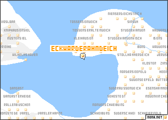
Eckwarder Ahndeich (Niedersachsen, Germany)Eckwarder Ahndeich is a town in the Niedersachsen region of Germany. An overview map of the region around Eckwarder Ahndeich is displayed below.
regional and 3d topo map of Eckwarder Ahndeich, Germany ::
Eckwarder Ahndeich airports ::
The nearest airport is WVN - Wilhelmshaven Mariensiel, located 13.1 km west of Eckwarder Ahndeich.
Other airports nearby include BRV - Bremerhaven (21.4 km east), BRE - Bremen (63.3 km south east), EME - Emden (69.4 km west), NRD - Norderney (70.7 km west), Nearby towns ::
Eckwarderhörne (1.9km north) //
Sinswürden (1.9km north) //
Großwürden (2.2km north west) //
Kleihausen (3.7km north) //
Eckwarder Altendeich (3.7km north) //
Eckwarden (2.9km north east) //
Hagen (3.9km north) //
Stick (5.7km north) //
Tossenser Altendeich (5.7km north) //
Seeverns (5.0km north east) //
Tossens (6.0km north) //
Tossenserdeich (7.4km north) //
Kleintossens (7.5km north) //
Düke (7.5km north) //
Ruhwarden (7.7km north) //
Süllwarden (7.1km north east) //
[all distances 'as the bird flies' and approximate] 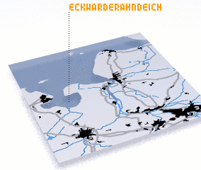 Places with similar names to Eckwarder Ahndeich, Germany :: Disclaimer :: Information on this page comes without warranty of any kind |
||
|
Where is Eckwarder Ahndeich? Elevation and coordinates ::
Latitude (lat): 53°31'0"N Longitude (lon): 8°15'0"E
Elevation (approx.): -32768m (map arrows pan, magnifying glasses zoom) |
||
|
Visiting Eckwarder Ahndeich? Hotel/Accommodation ::
Book a hotel in Eckwarder Ahndeich Travel Guide ::
Buy a travel guide for Germany rental cars ::
car rental offers GPS waypoint ::
download a GPX waypoint (PoI) of Eckwarder Ahndeich for your GPS receiver
|
||