|
search place name
|
||
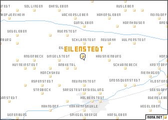
Eilenstedt (Sachsen-Anhalt, Germany)Eilenstedt is a town in the Sachsen-Anhalt region of Germany. An overview map of the region around Eilenstedt is displayed below.
regional and 3d topo map of Eilenstedt, Germany ::
Eilenstedt airports ::
The nearest airport is BWE - Braunschweig Wolfsburg, located 49.6 km north west of Eilenstedt.
Other airports nearby include ZCN - Celle (96.6 km north west), LEJ - Leipzig Halle (103.6 km south east), HAJ - Hannover (106.4 km north west), ERF - Erfurt (111.8 km south), Nearby towns ::
Röderhof (2.2km south west) //
Schlanstedt (3.7km north) //
Huysburg (2.9km south west) //
Arbketal (2.9km south west) //
Eilsdorf (2.9km north west) //
Neu Runstedt (5.6km south) //
Haus Nienburg (3.4km east) //
Dingelstedt (3.4km west) //
Aderstedt (6.0km north) //
Neudamm (5.0km north east) //
Sargstedter Siedlung (7.4km south) //
Gunsleben (7.4km north) //
Mönchhai (4.9km west) //
Sargstedt (6.5km south west) //
Mönchsheu (5.9km south west) //
Klein Quenstedt (7.8km south) //
Pabstorf (7.2km north west) //
Neuwegersleben (8.7km north east) //
[all distances 'as the bird flies' and approximate]  Places with similar names to Eilenstedt, Germany ::
// Ellenstedt (DE)
Disclaimer :: Information on this page comes without warranty of any kind |
||
|
Where is Eilenstedt? Elevation and coordinates ::
Latitude (lat): 51°59'0"N Longitude (lon): 11°2'0"E
Elevation (approx.): 118m (map arrows pan, magnifying glasses zoom) |
||
|
Visiting Eilenstedt? Hotel/Accommodation ::
Book a hotel in Eilenstedt Travel Guide ::
Buy a travel guide for Germany rental cars ::
car rental offers GPS waypoint ::
download a GPX waypoint (PoI) of Eilenstedt for your GPS receiver
|
||