|
search place name
|
||
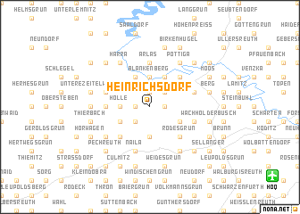
Heinrichsdorf (Bayern, Germany)Heinrichsdorf is a town in the Bayern region of Germany. An overview map of the region around Heinrichsdorf is displayed below.
regional and 3d topo map of Heinrichsdorf, Germany ::
Heinrichsdorf airports ::
The nearest airport is HOQ - Hof Plauen, located 13.1 km south east of Heinrichsdorf.
Other airports nearby include BYU - Bayreuth (42.9 km south), ERF - Erfurt (86.8 km north west), KLV - Karlovy Vary (87.3 km east), AOC - Altenburg Nobitz (88.3 km north east), Nearby towns ::
Eichenstein (1.9km north) //
Issigau (1.9km north) //
Griesbach (1.2km east) //
Hügel (1.2km west) //
Reitzenstein (2.2km north east) //
Oberklingensporn (2.2km south west) //
Mittelklingensporn (2.2km south west) //
Unterklingensporn (2.2km south west) //
Blankenberg (3.7km north) //
Hölle (2.4km west) //
Kleinschmieden (2.4km west) //
Froschgrün (3.7km south) //
Kemlas (3.9km north) //
Blankenstein (3.9km north) //
Rosenthal (3.9km north) //
Rothleithen (3.0km south east) //
Marxgrün (3.0km south west) //
Eisenbühl (4.4km north east) //
Saalbach (4.4km north east) //
Rodesgrün (4.4km south east) //
Dreigrün (4.4km south west) //
Arlas (5.6km north) //
Dörflas (3.5km west) //
Lichtenberg (4.0km north west) //
Hadermannsgrün (4.0km north east) //
Kohlbühl (4.0km south east) //
Neuhaus (4.0km south east) //
Naila (5.7km south) //
Pottiga (6.0km north east) //
[all distances 'as the bird flies' and approximate]  Places with similar names to Heinrichsdorf, Germany ::
// Heinrichsdorf (AT)
// Heinrichsdorf (DE)
// Heinrichsdorf (DE)
// Heinrichsdorf (DE)
// Heinrichsdorf (DE)
// Heinrichsdorf (DE)
// Heinrichsdorf (DE)
// Heinrichsdorf (DE)
// Hinrichsdorf (DE)
// Hinrichsdorf (DE)
Disclaimer :: Information on this page comes without warranty of any kind |
||
|
Where is Heinrichsdorf? Elevation and coordinates ::
Latitude (lat): 50°22'0"N Longitude (lon): 11°43'0"E
Elevation (approx.): 587m (map arrows pan, magnifying glasses zoom) |
||
|
Visiting Heinrichsdorf? Hotel/Accommodation ::
Book a hotel in Heinrichsdorf Travel Guide ::
Buy a travel guide for Germany rental cars ::
car rental offers GPS waypoint ::
download a GPX waypoint (PoI) of Heinrichsdorf for your GPS receiver
|
||