|
search place name
|
||
Pöthen (Sachsen-Anhalt, Germany)Pöthen is a town in the Sachsen-Anhalt region of Germany. An overview map of the region around Pöthen is displayed below.
regional and 3d topo map of Pöthen, Germany ::

Pöthen airports ::
The nearest airport is LEJ - Leipzig Halle, located 79.4 km south of Pöthen.
Other airports nearby include BWE - Braunschweig Wolfsburg (90.6 km west), TXL - Berlin Tegel (111.6 km north east), THF - Berlin Tempelhof (114.9 km east), SXF - Berlin Schonefeld (119.5 km east), Nearby towns ::
Karith (0.0km north) //
Neugut (2.2km south east) //
Nedlitz (3.7km north) //
Gommern (3.7km south) //
Büden (5.6km north) //
Wahlitz (3.4km west) //
Vehlitz (3.4km east) //
Pretzien (5.6km south) //
Dannigkow (3.9km south east) //
Zeddenick (5.0km north east) //
Plötzky (6.0km south) //
Ziepel (6.0km north) //
Menz (4.9km west) //
Pilm (4.9km west) //
Wörmlitz (7.5km north) //
Bergfeld (6.5km south west) //
Königsborn (5.9km north west) //
Neu Königsborn (5.9km north west) //
Woltersdorf (7.2km north west) //
Dornburg (8.2km south east) //
Elbenau (8.7km south west) //
[all distances 'as the bird flies' and approximate] 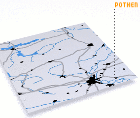 Places with similar names to Pöthen, Germany ::
Disclaimer :: Information on this page comes without warranty of any kind |
||
|
Where is Pöthen? Elevation and coordinates ::
Latitude (lat): 52°6'0"N Longitude (lon): 11°50'0"E
Elevation (approx.): 56m (map arrows pan, magnifying glasses zoom) |
||
|
Visiting Pöthen? Hotel/Accommodation ::
Book a hotel in Pöthen Travel Guide ::
Buy a travel guide for Germany rental cars ::
car rental offers GPS waypoint ::
download a GPX waypoint (PoI) of Pöthen for your GPS receiver
|
||